RIT Partners with Leader in Remote Sensing to Enhance Homeland Security
The software donation will be used in the center’s remote sensing work with the Monroe County Office of Emergency Preparedness and the Department of Homeland Security. The center is currently working with these groups to provide more accurate mapping and location technologies to be used during possible terrorist attacks or national emergencies.
WHAT: Announcement of Leica Center of Excellence at RITWHO: Representatives from Leica Geosystems and RIT
WHEN: 11 a.m. Wednesday, Oct. 26, 2005
WHERE: Rochester Institute of Technology Chester F. Carlson Center, Auditorium Rochester, N.Y.
Recommended News
-
April 24, 2024
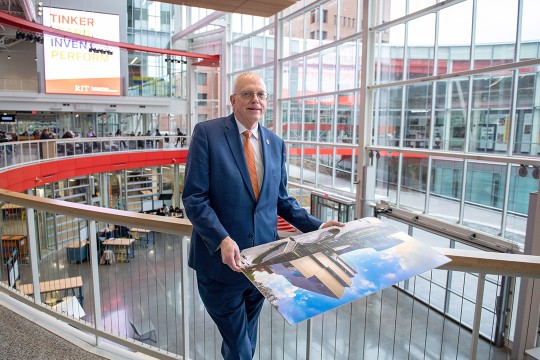
!['David Munson, Jr., RIT President, stands on the second floor balcony of the SHED holding a portrait that shows the renderings before it was built. ']()
RIT President David Munson to step down in 2025
Spectrum News features David Munson's retirement plans for 2025, emphasizing his impact on RIT's growth in enrollment, research funding, and global presence. -
April 24, 2024
!['A blurry image of a leafy green wooded area']()
Nearsightedness is at epidemic levels – and the problem begins in childhood
The Conversation talks to Andrew Hebert, professor in the Department of Psychology, about the global rise of myopia and its causes, including increased screen time and reduced outdoor exposure.
-
April 24, 2024
!['a colorful 3 D image of the southern ring nebula appears in a black sky.']()
See the Southern Ring Nebula in 3D
Universe Today highlights the research led by Joel Kastner, professor in the Chester F. Carlson Center for Imaging Science, on the Southern Ring Nebula's dual-ring formation and the possible role of a second star.
-
April 24, 2024
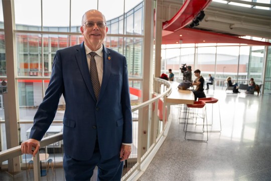
!['David Munson, Jr., RIT President, stands on a balcony on the second level of the SHED.']()
RIT President Munson to retire
The Rochester Beacon covers David Munson's retirement announcement, highlighting his transformative impact on the university's creativity, innovation, and academic excellence.