RIT and Geospatial Systems Inc. Unveil New Airborne Imaging System
Technology advances use of remote sensing in homeland security and incident response
Geospatial Systems Inc. and Rochester Institute of Technology recently completed a joint project demonstrating a compact, rapidly-deployable airborne imaging system for emergency and tactical applications. The system greatly enhances image quality, resolution and geo-positioning capabilities, while also reducing the set-up and installation time required for airborne deployment.
Geospatial Systems is currently commercializing the technology as part of their TerraPix platform product line for airborne survey and mapping. The TerraPix system is designed for use in homeland security, incident response, asset monitoring and defense. The TerraPix is already being installed in an unmanned aerial vehicle for a U.S. Army urban surveillance program, and in a UAV for a U.S. Navy sponsored project.
“Geospatial Systems is pleased to combine our leading-edge technologies and products with the educational resources of RIT to make advances in the airborne imaging market,” says Maxime Elbaz, president and CEO, Geospatial Systems Inc. “Equipping emergency response teams with the essential tools to provide the highest quality assistance to the community is a project we are very proud to take part in.”
“Our long-standing partnership with Geospatial Systems continues to demonstrate the value of pairing the talent and expertise of a university with the drive and innovation of industry,” adds Harvey Rhody, director of the Laboratory for Imaging Algorithms and Systems within the Chester F. Carlson Center for Imaging Science at RIT.
As part of the joint effort, Geospatial Systems donated a TerraPix sensor controller, along with one of their high-precision KCM digital imaging modules to the Laboratory for Imaging Algorithms and Systems. The research partnership focused on integrating the imaging system payload, including the geo-positioning device, as well as improving the system’s ability to process and compress high volumes of data and stream it over a digital data link. The project was co-funded by Geospatial Systems, RIT, and the New York State Foundation for Science, Technology and Innovation.
Note: Geospatial Systems Inc. is a Rochester based company that designs and produces airborne georeferenced remote sensing systems for commercial and military applications, including mapping, environmental monitoring, homeland security, reconnaissance and persistent surveillance.
Rochester Institute of Technology is internationally recognized for academic leadership in computing, engineering, biotechnology, imaging technology, and fine and applied arts, in addition to unparalleled support services for students with hearing loss. More than 15,800 full- and part-time students are enrolled in RIT’s 340 career-oriented and professional programs, and its cooperative education program is one of the oldest and largest in the nation.
Topics
Recommended News
-
April 17, 2024
![a generated image of the new main concourse of a staium is displayed with the field to the left and a concession stand to the right.]()
RIT to break ground on new athletic stadium
Rochester Business Journal talks about the new athletics stadium being built on the RIT campus.
-
April 17, 2024
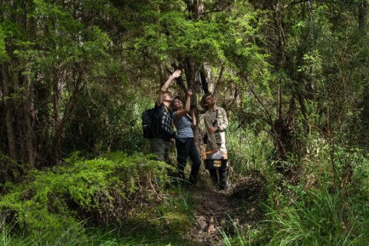
![Three biologists in a wooded area gaze up toward the treetops, looking for birds.]()
Should We Change Species to Save Them?
The New York Times cites a paper co-authored by Evelyn Brister, professor in the Department of Philosophy, about Conservation science.
-
April 17, 2024
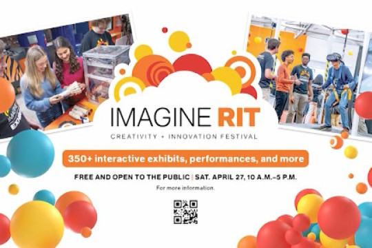
![a poster showcasing colorful balloons and an Imagine RIT banner is displayed with the date and time of the event.]()
WHY ROC: Imagine RIT Creativity and Innovation Festival
WROC-TV talks to Ann Ielapi, senior director of events and conferences for Government and Community Relations, about the upcoming Imagine RIT festival.
-
April 17, 2024
![a hand in a blue glove is holding a test tube containing large amounts of microplastics.]()
New microplastics research hub aims to unravel health impact in changing climate
RIT is spearheading a transformative $7.3 million research hub in collaboration with the University of Rochester. The center will study the lifecycle of microplastics, including its origin as plastic waste, distribution, and movement in the Great Lakes freshwater ecosystem.