RIT professor uses mapping to help Syrian refugees
Research project seeks to improve refugee’s situation awareness, spatial thinking and mapping skills
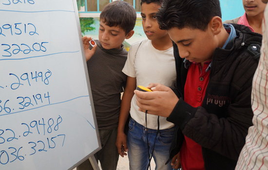
Brian Tomaszewski
RIT assistant professor Brian Tomaszewski plays a geocaching game with residents of the Za’atari Syrian refugee camp in Jordan. The professor is conducting some of the first research on the situation awareness and spatial thinking skills of refugees in a camp environment.
A Rochester Institute of Technology professor is hoping to improve the lives of refugees by studying how Syrian refugees and refugee camp organizers use maps.
For the millions of Syrian refugees forced to leave their homes and live in refugee camps, the experience can be disorienting. The sudden nature of displacement can make it difficult for residents to gain situation awareness—a deep understanding what is going on around them.
Brian Tomaszewski, an assistant professor who specializes in geospatial technologies, is conducting some the first research on the relationship between people’s spatial thinking skills and their situation awareness in refugee camps.
He plans to use the findings to create maps that are easier for refugees and humanitarian organizations to use, allowing refugees to get the resources they need and live happier lives. He will also teach refugees how to create their own maps and use digital GPS equipment.
“It’s really all about empowering people who have been displaced from their homes and their lives,” said Tomaszewski. “We want to figure out how refugees are thinking spatially about the camp and what’s important to them.”
Tomaszewski began collecting preliminary data in November, during a trip to the Za’atari refugee camp in Jordan—the second largest refugee camp in the world with nearly 80,000 residents. The professor is part of a NSF-funded research team that has been traveling to Za'atari to use mapping to survey Internet usage and mitigate disaster situations.
While in Za’atari, he measured spatial thinking and situation awareness by asking 36 participants to draw a mental map of what they think the camp looks like. Maps varied from five buildings showing the residents route from home to school to detailed drawings that showed a top-down camp view. He also conducted several spatial thinking ability tests and map usage surveys. He is working with RIT student Sara Tibbetts, a fourth-year computer engineering major with a geographic information systems (GIS) minor, to analyze the data.
“We found that refugees definitely value the use of maps—they use them to make future plans and find things within and around the camp,” said Tomaszewski, who teaches in RIT’s B. Thomas Golisano College of Computing and Information Sciences. “Culture and gender are also at play here, as I saw major differences in how men and women drew their mental maps.”
It was also noted that a refugee camp the size of Za’atari—which is basically a small city—refugees had varying levels of map reading skills, as many of the residents came from more rural areas of Syria, Tomaszewski said.
For the United Nations High Commission for Refugees (UNHCR) Agency and other humanitarian organizations running camps, maps are used to maintain various infrastructures and to convey public service announcements, including where construction is happening and how to prepare for winter. Tomaszewski noted how important it is for maps to be designed with refugees in mind, not just the humanitarian workers.
In addition to gathering research data, Tomaszewski taught several residents how to use GPS equipment through a geocaching game, as a means for building mapping and spatial thinking skills.
“Many of the residents had a genuine interest in learning about how maps can be used to help the camp,” said Tomaszewski. “We hope to give residents the tools and training to improve their lives and possibly get jobs in the geospatial industry.”
Tomaszewski plans to continue the two-year project and go back to Za’atari to conduct more interviews and map training with refugees.
Recommended News
-
April 24, 2024
![a colorful 3 D image of the southern ring nebula appears in a black sky.]()
See the Southern Ring Nebula in 3D
Universe Today highlights the research led by Joel Kastner, professor in the Chester F. Carlson Center for Imaging Science on the Southern Ring Nebula's dual-ring formation and the possible role of a second star.
-
April 24, 2024
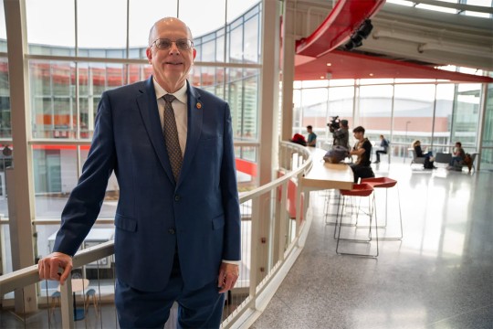
![David Munson, Jr., RIT President, stands on a balcony on the second level of the SHED.]()
RIT president Munson to retire
The Rochester Beacon covers RIT President David Munson's retirement announcement, highlighting his transformative impact on the university's creativity, innovation, and academic excellence.
-
April 24, 2024
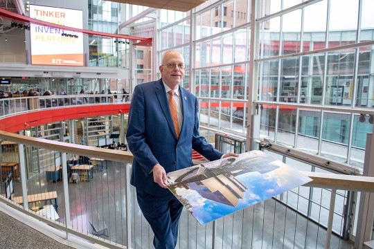
![David Munson, RIT President, stands on the second floor balcony of the SHED holding a portrait that shows the renderings before it was built.]()
RIT President Munson announces plans to retire in 2025
The Rochester Business Journal details David Munson's retirement from RIT in 2025, celebrating his contributions to transforming the university into a leading research institution. (This content may require a subscription to view).
-
April 23, 2024
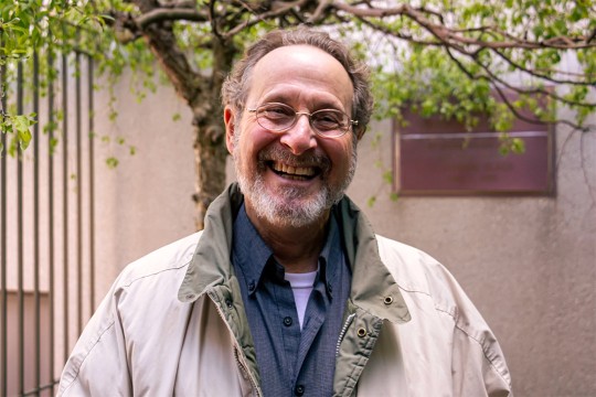
![Leigh Rubin is shown in a tan jacket standing in a courtyard smiling with glasses on.]()
How thinking like a cartoonist can open your mind
WXXI talks to cartoonist-in-residence Leigh Rubin about how his book Think Like a Cartoonist inspires creative problem-solving.