RIT, Pictometry expand drone research partnership
New facility will help advance development of unmanned aircraft systems and solve issue of university’s proximity to the Greater Rochester International Airport

Agamemnon Crassidis and Frank Giuffrida
Rochester Institute of Technology is partnering with Pictometry to build an Outdoor Netted Enclosure Lab for research and academic coursework related to unmanned aircraft systems, also referred to as drones.
The enclosure, one of the first installed at a Northeast university, is part of an expanded research partnership between the university and the Rochester-based imaging company to advance development and testing of unmanned aircraft system technologies.
“This lab will allow students and researchers alike to build systems and fly and test them without the burden of researching regulations and safety issues related to open, outdoor drone flights,” said Frank Giuffrida, executive vice president of engineering at EagleView Technology Corp. Pictometry is a wholly-owned subsidiary of EagleView. “The netted enclosure lab is an ideal test environment that allows full access to GPS signals that are essential for drone operation.
“In addition to advancing our research efforts, the lab also provides a great opportunity for RIT students to learn more about UAS technology and the science behind it, such as imaging capture, flight control and sense and avoidance.”
The outdoor, 100-by-100-by-50-foot enclosure will be located adjacent to the RIT campus and open all year. Researchers could incorporate important test variables such as the impact of weather conditions on signal processing, for example, into research projects. The new enclosure would also meet Federal Aviation Administration requirements stating unmanned aircraft cannot fly within five miles of an airport. (RIT’s campus is located within this vicinity; just under five miles from the Greater Rochester International Airport.) Regulations currently do not permit commercial, unmanned aircraft above 400 feet without certification, and these allowances are given primarily to law enforcement or the military.
“You can fly the drones indoors, but much of the research relies on how the global positioning system is used on board, and you don’t get the weather elements. Both can be very useful in regard to designs for specific applications,” said Agamemnon Crassidis, associate professor of mechanical engineering in RIT’s Kate Gleason College of Engineering. He will manage the structure and much of the research and testing expected to take place at the outdoor facility. “With this type of enclosure, it’s like flying indoors, so you won’t need any special certifications from the FAA.”
The merger of EagleView Technology Corp. and Pictometry International in January 2013 created a company with technological solutions in global information systems, measurement and analysis, and provides powerful high-resolution aerial imagery and analytical tools for assessment, public safety, emergency response and overall visualization needs. Some of the imagery captured by Pictometry is enabled by unmanned aircraft systems, and the company has been involved in advancing that technology capacity through projects with the NUAIR Alliance and RIT.
NUAIR, the Northeast UAS Airspace Integration Research Alliance, is a group of more than 40 companies and universities in New York and Massachusetts selected in December 2013 as one of six FAA test sites in the U.S. The alliance conducts research to improve unmanned aircraft technology and will recommend safe integration of unmanned aircraft in the national airspace system. Seventeen universities are involved with RIT and Massachusetts Institute of Technology as regional academic leaders.
“We’ll have this facility at RIT, so if there are customers that come through NUAIR who want to fly right away, we’ll have this facility available,” said Crassidis, who is RIT’s representative on NUAIR. He specializes in aircraft control systems and has worked for aerospace companies such as Calspan, an affiliate of the Flight Research Facility in Buffalo, N.Y., specifically part of the team that designed flight simulation systems for jet fighter pilots.
Future plans also include working with faculty at Monroe Community College to organize a regional collegiate student design competition and to offer demonstrations of different types of drones and systems to K-12 audiences, he added.
Related articles:
The Sky’s the Limit: RIT becomes part of national plan to improve use of unmanned aircraft systems: https://www.rit.edu/news/athenaeum_story.php?id=50671
Designing a roadmap for U.S. airspace: https://www.rit.edu/news/story.php?id=50913
Recommended News
-
April 25, 2024
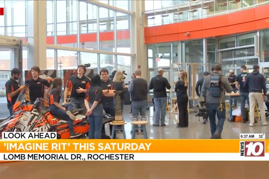
!['Students are shown gathering around a snowmobile, which is one of the exhibits at Imagine RIT.']()
Imagine RIT returns Saturday with over 400 student exhibits
WHEC-TV showcases Imagine RIT, spotlighting diverse exhibits from neurotechnology and virtual reality to glass blowing and astronomy. -
April 25, 2024
![I voted sticker and checkmark.]()
Informed voting in the age of Artificial Intelligence
Artificial intelligence (AI) has entered the election—globally. To help voters navigate these advancements in social media, deepfakes, manipulated images, and cybersecurity, a few RIT experts are weighing in.
-
April 25, 2024
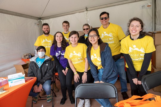
!['a group of staff members in yellow shirts gather under a tent being used as an information booth.']()
Staff volunteers make Imagine RIT shine
RIT staff members volunteer at the festival to assist the university in creating an unforgettable event each year by handing out welcome bags, supervising parking lots, and showing campus visitors around the bustling campus, among other duties. More than 200 staff volunteers annually commit their time to Imagine RIT.
-
April 24, 2024
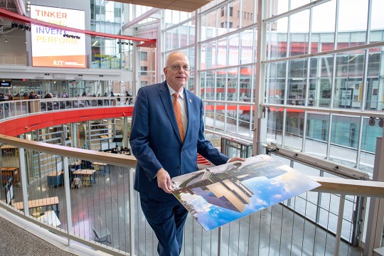
![David Munson, Jr., RIT President, stands on the second floor balcony of the SHED holding a portrait that shows the renderings before it was built.]()
RIT President David Munson to step down in 2025
Spectrum News features David Munson's retirement plans for 2025, emphasizing his impact on RIT's growth in enrollment, research funding, and global presence.