Using Geospatial Technologies to Explore Geography in the Thousand Islands
RIT and SUNY Geneseo students team up for geography field experience
Brian Tomaszewski
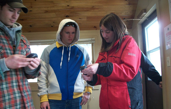
Erin Kiselica, a fourth-year computer science major at RIT, explains the use of Global Positioning Systems and other geospatial technologies to SUNY Geneseo students while at a field experience course in the Thousand Islands.
Geospatial technologies, such as Global Positioning Systems and Geographic Information Systems, are technologies and equipment used to measure, represent and analyze the earth.
Thanks to geospatial technologies, we are able to do things such as use a handheld GPS to find our way around town, map the flood plains and protect the U.S. borders 24 hours a day. Geospatial technology has also brought together students from Rochester Institute of Technology and SUNY Geneseo who want to learn more about geography and technology.
Erin Kiselica, a fourth-year computer science major at RIT, and Brian Tomaszewski, assistant professor in RIT’s Department of Information Sciences and Technologies, were invited to attend a field experience course with members of the SUNY Geneseo geography department in April.
The field experience took place in the Thousand Islands region of New York and Canada and provided the students with a chance to use their powers of observation and interpretation for geographical inquiry.
“Geography is a discipline that is very much about going out and experiencing places and things,” says Tomaszewski.
“Each student at the field experience was required to teach a session on anything they wanted that was geography related. I chose GPS and GIS because of my experiences in Brian’s Introduction to Geospatial Technologies course at RIT,” says Kiselica.
The goal of the geospatial technologies course is to expose students to foundational concepts and technologies of the field. Students gain hands-on experience with geospatial technologies, including GPS, GIS, Virtual Globes (Google Earth) and Web 2.0 “mapping mashups.”
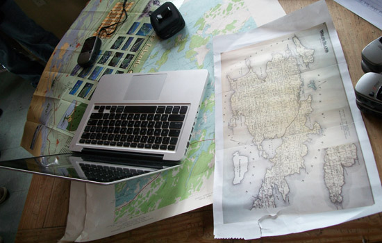
“While in the Thousand Islands I used Google Earth to import historical maps of the area and georeference them,” says Kiselica. “By adding transparency, we were able to see changes in the shoreline over time due to the St. Lawrence Seaway project.”
Kiselica also gave a lecture on how GPS works and its uses in both the public and private sector. As part of the demonstration, Kiselica used a GPS to search for a “geocache” in the area.
“Geocaching is a scavenger hunt using a GPS. Using coordinates found on a geocaching website, you search for containers that other ‘cachers’ have hidden all over the world,” explains Kiselica. “One we found in the Thousand Islands, an old ammo box, included a few trinkets and a logbook.”
Other lectures included discussion of the windmills on Wolfe Island, the effects of the Rideau Canal and ghost hunting in the Thousand Islands.
“This is the first time that SUNY Geneseo has invited us to work with them for the field experience course. I would really like to continue this collaboration and hopefully see SUNY Geneseo students coming to RIT for graduate studies,” says Tomaszewski.
“I normally look at geography from the technology side because I am a computer science major,” says Kiselica. “This experience was a really interesting new twist for me and I would encourage anyone to do it.”
 Geospatial technology used to explore the geography of the Thousand Islands region. Brian Tomaszewski
Recommended News
-
April 25, 2024
![a group of staff members in yellow shirts gather under a tent being used as an information booth.]()
Staff volunteers make Imagine RIT shine
RIT staff members volunteer at the festival to assist the university in creating an unforgettable event each year by handing out welcome bags, supervising parking lots, and showing campus visitors around the bustling campus, among other duties. More than 200 staff volunteers annually commit their time to Imagine RIT.
-
April 24, 2024
![David Munson, Jr., RIT President, stands on the second floor balcony of the SHED holding a portrait that shows the renderings before it was built.]()
RIT President David Munson to step down in 2025
Spectrum News features David Munson's retirement plans for 2025, emphasizing his impact on RIT's growth in enrollment, research funding, and global presence. -
April 24, 2024
![A blurry image of a leafy green wooded area]()
Nearsightedness is at epidemic levels – and the problem begins in childhood
The Conversation talks to Andrew Hebert, professor in the Department of Psychology, about the global rise of myopia and its causes, including increased screen time and reduced outdoor exposure.
-
April 24, 2024
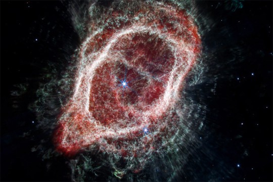
![a colorful 3 D image of the southern ring nebula appears in a black sky.]()
See the Southern Ring Nebula in 3D
Universe Today highlights the research led by Joel Kastner, professor in the Chester F. Carlson Center for Imaging Science, on the Southern Ring Nebula's dual-ring formation and the possible role of a second star.