Landsat Image Systems Support
Principal Investigator(s)
Matthew Montanaro
Research Team Members
Aaron Gerace
Rehman Eon
Michael Gartley
Project Description
This project provides science systems engineering support for the NASA Landsat program. The PI serves as the deputy instrument scientist for the Landsat 10 (formerly Landsat Next) project which involves being an interface among the instrument vendor, NASA, and USGS project teams for science-related requirements. Team members ensure that raw pixel data from the detectors are properly recorded, processed, compressed, downlinked, verified, and calibrated on the ground. The team also provides modeling expertise to enable science traceability between instrument requirements and image science products. Additionally, the PI serves on the Landsat Calibration/Validation team and is responsible for continuing on-orbit characterization and calibration of the Landsat 8 / Thermal Infrared Sensor (TIRS) and the Landsat 9 / Thermal Infrared Sensor 2 (TIRS-2) instruments. Team members also provide technical expertise and guidance on Landsat instrument technology development.
Over the past year, the PI has been primarily tasked with reviewing technical data from the Landsat 10 instrument vendor, Raytheon, in preparation for the instrument preliminary design review (PDR) in Sept 2025 and the upcoming critical design review (CDR) in Jan 2027. This involves leading and participating in technical interchange review meetings with the NASA, USGS, RIT, and Raytheon teams. The PI was also heavily involved with the re-planning of the Landsat Next mission by providing technical and science guidance to Goddard project management and NASA HQ management. These efforts led to the modified Landsat 10 mission architecture that retained most of the original Landsat Next plans. RIT team members have become more integrated into the Landsat project team by providing science traceability to mission requirements and by generating simulated science data for use in instrument simulators and ground system demonstrations. Work continues on image compression analysis for the instrument through graduate student work that developed a software implementation of the CCSDS 123.0-B-2 compression standard with follow-on work to develop an FPGA implementation for comparison to eventual flight data from the instrument. The PI also maintained discussions with European officials and NASA officials involved with acquiring commercial image data to ensure that image compression strategy is consistent across missions. The PI was also involved in introductions to the new Landsat Science team to bring them up to speed on the Landsat 10 project and traceability of requirements to current Landsat 8 and 9 performance. Finally, the PI continued to support the on-going operations of the TIRS instruments onboard Landsat 8 and Landsat 9 through analyses of in-flight calibration data with the Landsat Cal/Val team and by assisting the Flight Operations team with recovering from instrument anomalies.
Figures and Images
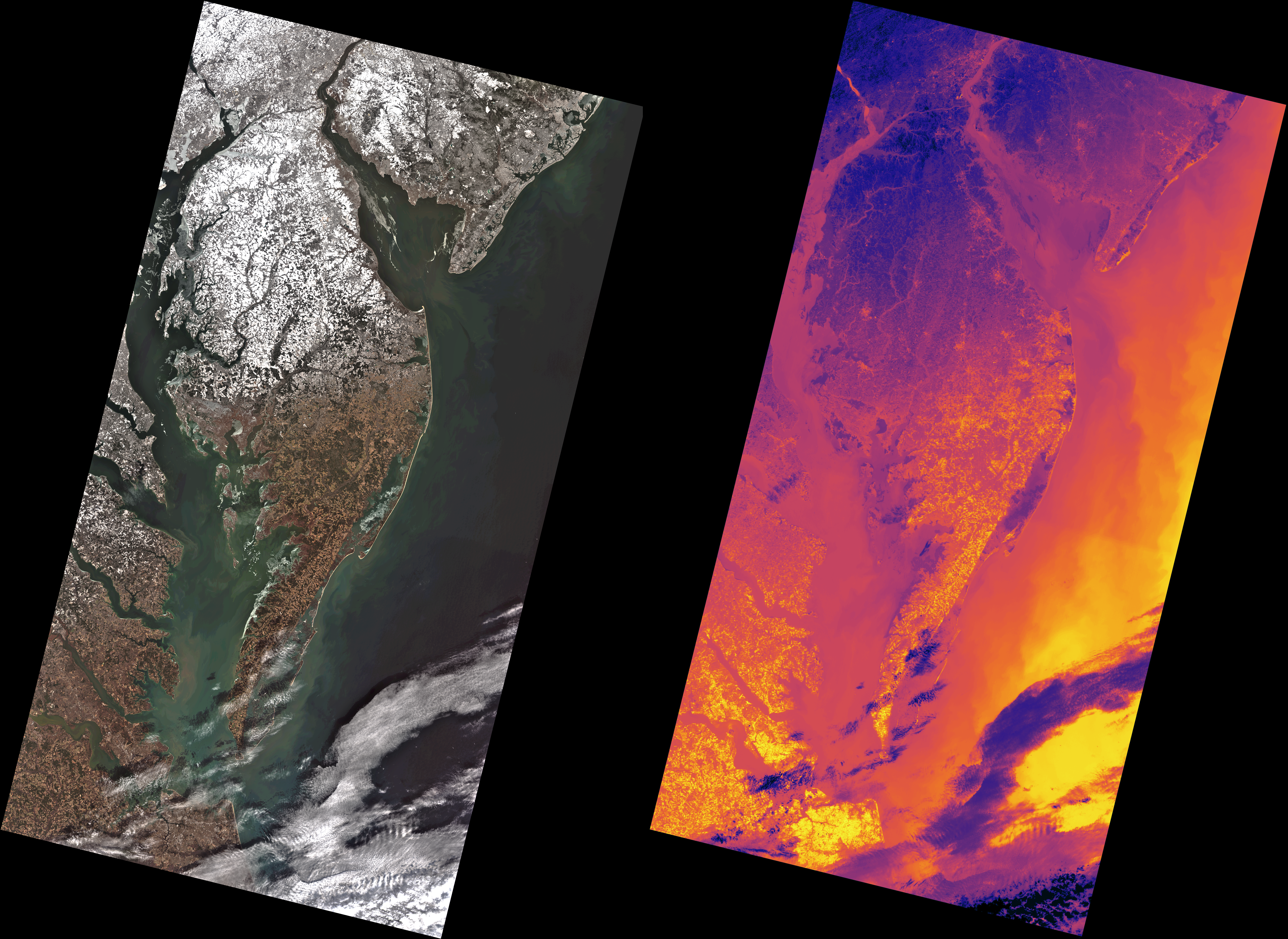
Landsat 9 images of the DelMarVa peninsula acquired on 2026-02-05 after an unusual snow storm in the Washington, DC area. The left image was acquired by the OLI-2 instrument (in natural color) and the right image by the TIRS-2 instrument (in thermal false color). The false color thermal image is stretched between temperatures of 257K (purple) and 272K (yellow). Image is 185 km wide with a pixel size of 30 meters. North is straight up.