Longwave Thermal Infrared Atmospheric Compensation Using In Situ Scene Elements: Accurate Temperature Determination of Blackbody and Graybody Targets From Small Unmanned Aircraft Systems
Principal Investigator(s)
Carl Salvaggio
Research Team Members
William C. Barden
Josephine G. Clapp
Anthony Guarino
Adele L. Jones
Cooper O’Connell-Williams
Gian-Mateo A. Tifone
Joseph A. Walker
Timothy D. Bauch
Project Description
Accurate determination of surface temperature from small unmanned aircraft system (sUAS) acquired longwave infrared (LWIR) imagery requires compensation for atmospheric transmission, upwelling path radiance, and reflected downwelling radiance. The multiple-altitude technique has previously been demonstrated as an effective approach for estimating atmospheric transmission and upwelling radiance, but its practical application has relied on the assumption of high-emissivity targets of interest for which reflected downwelling radiance is negligible. This assumption limits applicability in agricultural and natural-scene environments, where canopies, soils, senescent vegetation, and man-made reference materials often behave as graybodies.
This study extends the multiple-altitude framework by incorporating a multiple-angle observation strategy for estimating downwelling radiance. LWIR imagery was collected over ground reference blackbody and graybody targets using a radiometrically calibrated sUAS at typical sUAS altitudes. Retrieved target temperatures were validated against independent \insitu measurements and evaluated using absolute error metrics and statistical significance testing.
Results show that the multiple-altitude technique remains effective for high-emissivity targets, but produces systematic temperature overestimation for lower-emissivity graybody surfaces when reflected downwelling radiance is neglected. Incorporating the multiple-angle compensation reduced average graybody temperature error from approximately 2.76K to 1.16K across the analyzed flights. These results demonstrate that explicit treatment of reflected downwelling radiance is necessary for physically consistent temperature retrieval from realistic sUAS thermal imagery and is directly relevant to agricultural applications requiring accurate canopy or soil temperature, including crop water stress assessment, evapotranspiration estimation, irrigation scheduling, and phenotyping.
Figures and Images
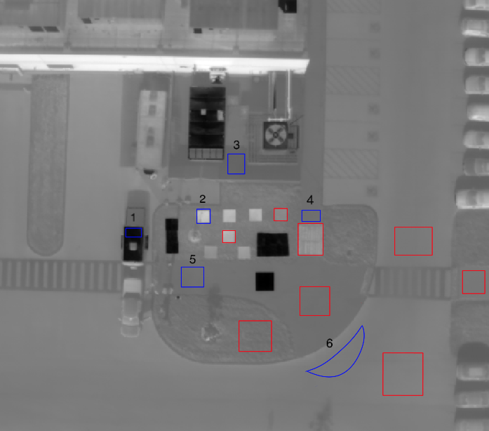
Teledyne FLIR SIRAS longwave thermal infrared image depicting the in situ targets used for determination of atmospheric transmission, upwelling path radiance, and hemispheric downwelling radiance using the multiple altitude and multiple angle technique. Targets are viewed looking at nadir and at 30 degrees off nadir to obtain data to determine these atmospheric compensation parameters.
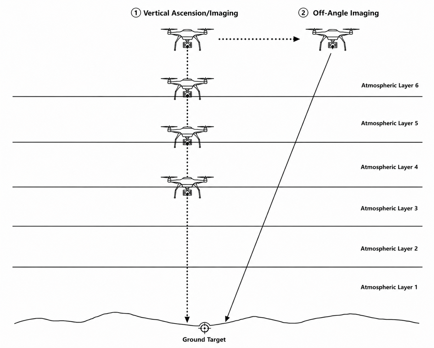
Radiance data acquisition strategy at multiple altitudes (nadir-looking) and off-nadir viewing locations for each reference target used.
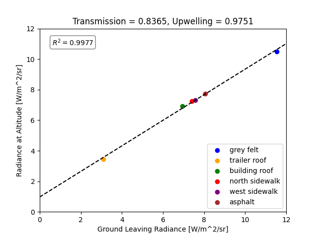
At-altitude v. ground-leaving radiance for several in situ targets used to determine the atmospheric transmission (slope) and the upwelling path radiance (intercept) at the final flight altitude.