Modeling Polarimetric Effects for Landsat 10
Principal Investigator(s)
Rehman Eon
Research Team Members
Michael Gartley
Aaron Gerace
Matthew Montanaro
Amirhossein Hassanzadeh
Project Description
The upcoming NASA/USGS Landsat 10 mission will significantly expand aquatic remote sensing capabilities through the Landsat Instrument Suite (LandIS), which includes twelve visible and near-infrared (VNIR) bands designed to improve monitoring of inland and coastal water quality. Because the water-leaving radiance represents only a small fraction of the total top-of-atmosphere signal, even small radiometric errors can propagate into substantial uncertainties in retrieved water-quality products. One potential source of error is sensor polarization sensitivity, which can introduce systematic measurement biases due to polarized scattering within the atmosphere and at the air-water interface.
This project develops a comprehensive physics-based modeling framework to quantify the impact of instrument polarization sensitivity on aquatic constituent retrievals and establish science traceability between instrument performance requirements and Level-3 science products. The framework combines Hydrolight simulations of water-leaving radiance with polarized atmospheric radiative transfer calculations using MODTRAN-P to generate realistic polarized top-of-atmosphere observations. Instrument characteristics, including band-dependent signal-to-noise ratio (SNR) and polarization sensitivity (PF), are then incorporated before atmospheric correction and constituent retrieval.
The analysis includes more than 36,000 simulated observation scenarios spanning a wide range of atmospheric conditions, solar illumination geometries, and optically complex inland and coastal waters representative of Case-2 environments. Retrieval performance is evaluated for chlorophyll-a (CHL), total suspended sediments (TSS), and colored dissolved organic matter (CDOM) using a physics-based lookup-table inversion framework.
Results demonstrate that retrieval uncertainty increases with solar zenith angle (SZA) due to stronger polarization effects under oblique illumination conditions. Under nominal Landsat 10 instrument requirements, retrieval errors remain relatively small; however, degradation in polarization performance produces measurable increases in constituent retrieval uncertainty, particularly under high solar zenith angle conditions. The study also shows that the expanded Landsat 10 VNIR spectral configuration provides substantial improvements in aquatic retrieval performance compared with the current Landsat 8/9 Operational Land Imager.
The project establishes an end-to-end methodology for propagating instrument-level polarization effects through atmospheric correction and aquatic retrieval algorithms, providing quantitative guidance for sensor design, calibration, and performance requirements. These results directly support NASA’s Science Traceability Matrix process by linking engineering specifications with expected science product performance. The modeling framework can also be extended to evaluate future Earth observation missions and other applications where polarization sensitivity influences radiometric accuracy.
Figures and Images
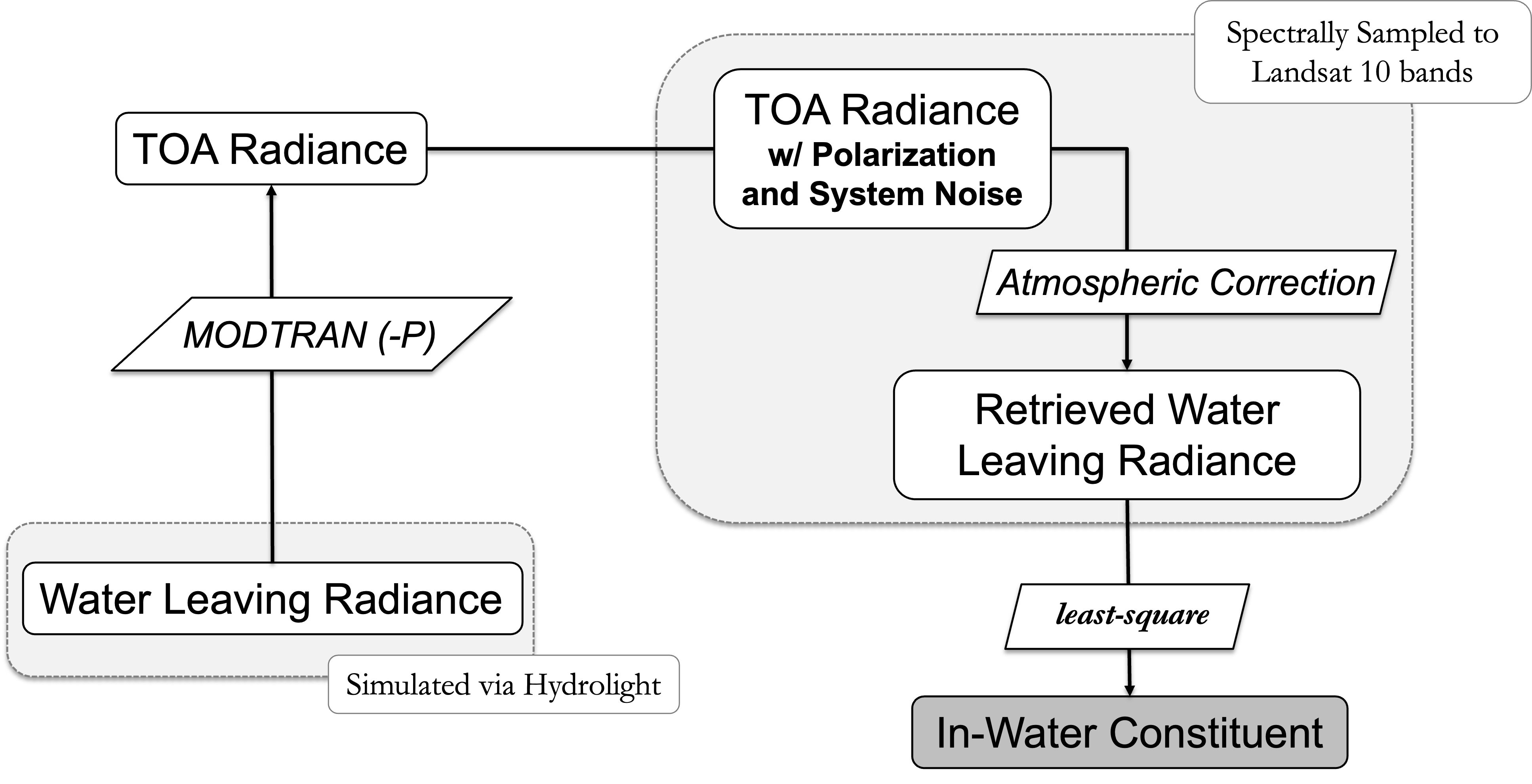
End-to-end simulation framework combining Hydrolight, MODTRAN-P, instrument modeling, atmospheric correction, and aquatic constituent retrieval.
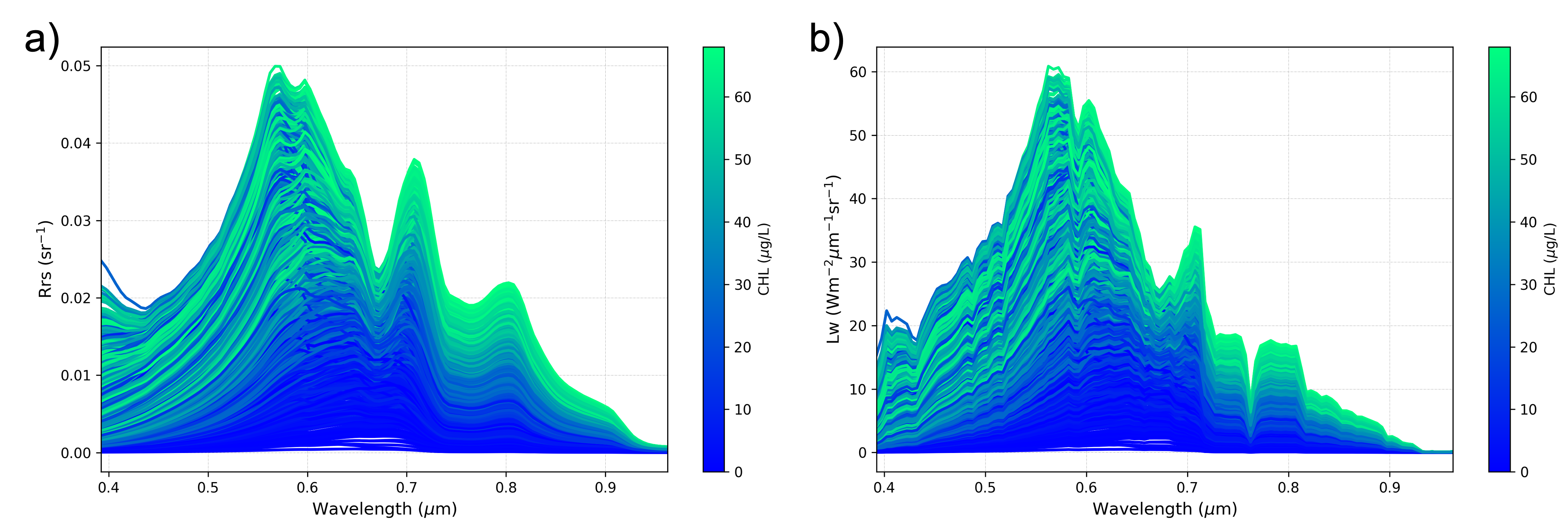
Simulated water-leaving radiance spectra for 2,000 Case-2 water conditions spanning a wide range of chlorophyll-a, suspended sediment, and colored dissolved organic matter concentrations.
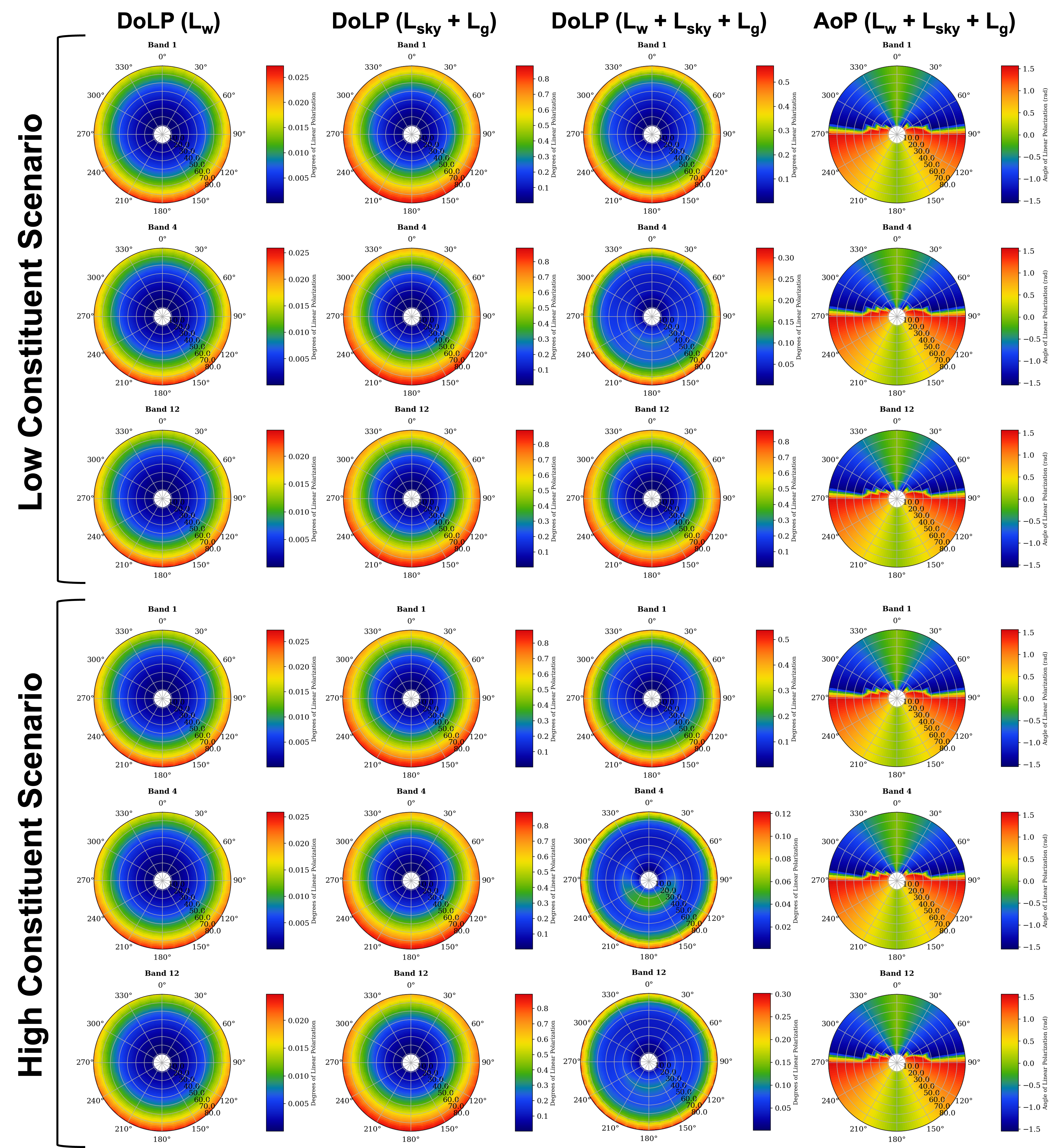
Distribution of the degree of linear polarization (DoLP) for representative clear-water and high-constituent water scenarios illustrating the relative contributions of surface reflection and subsurface scattering.
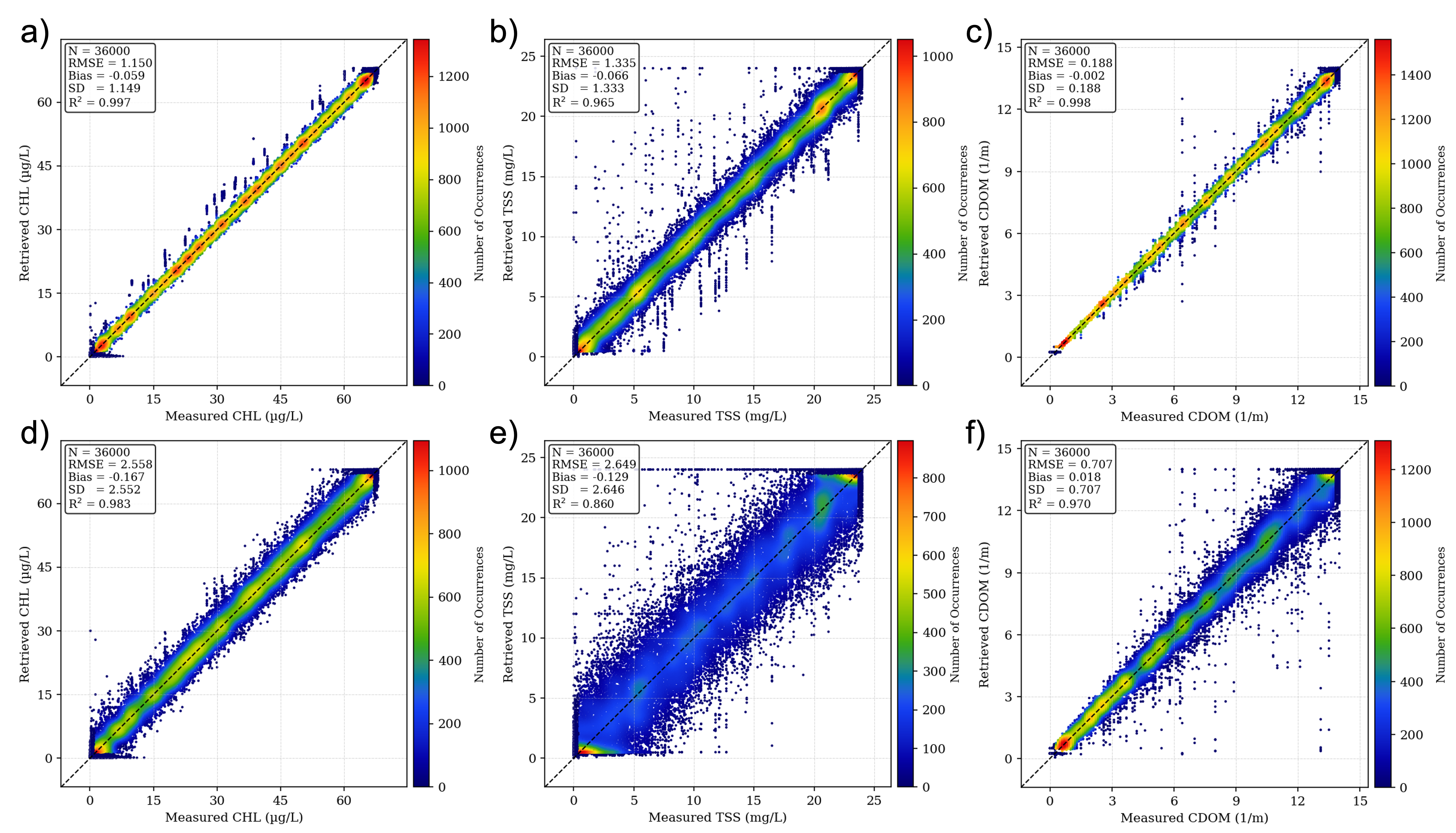
1:1 comparison between measured and retrieved in-water constituent concentrations, assuming instrument SNR and PF consistent with the LandIS requirements. Figures (a) to (c) show the retrieval performance for CHL, TSS, and CDOM at SZA = 40 deg while (d) to (f) show the corresponding retrievals at SZA = 76 deg.
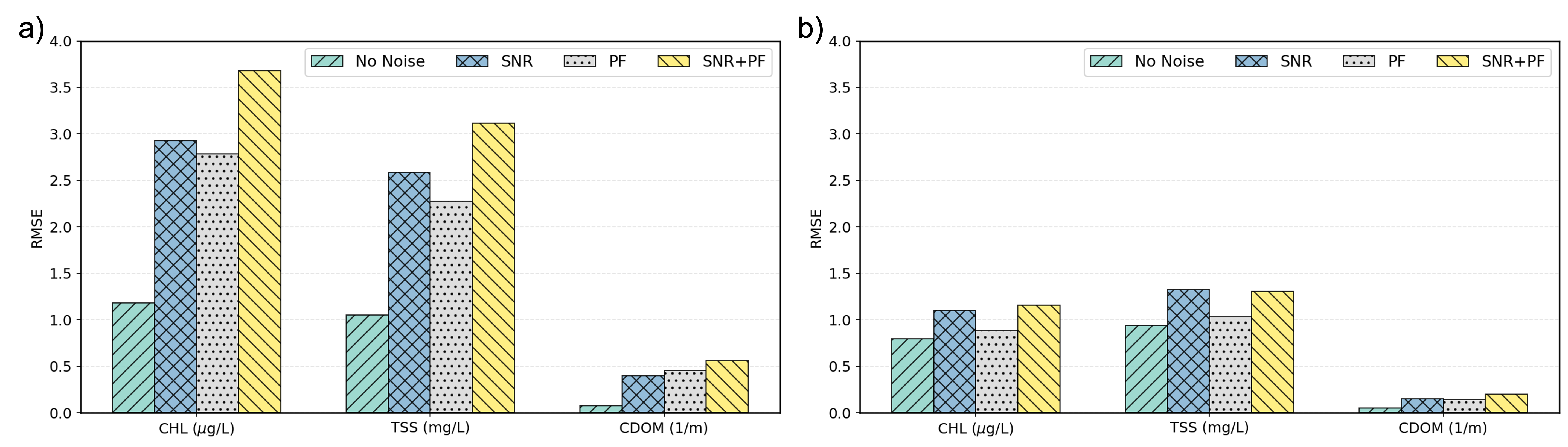
Comparison of retrieval performance for (a) the heritage Landsat 8/9 OLI band configuration (5 bands) and (b) the LandIS VNIR band configuration (12 bands). RMSE values for CHL, TSS, and CDOM are shown for four noise scenarios: no noise (algorithmic error only), SNR only, PF only, and combined SNR+PF.