A New Tool to Monitor the Resilience of Mangroves to Sea Level Rise
Principal Investigator(s)
Rob Chancia
Research Team Members
Jan van Aardt
Masasinge Hideos (Undergraduate Student / RIT ENVS)
Fei Zhang
Ali Rouzbeh Kargar
Project Description
Mangrove forests attempt to maintain their forest floor elevation through root growth, sedimentation, resistance to soil compaction, and peat development in response to sea level rise. Human activities, such as altered hydrology, sedimentation rates, and deforestation, can hinder these natural processes. As a result, there have been increased efforts to monitor surface elevation change in mangrove forests. Terrestrial lidar system (TLS) data were collected from mangrove forests in Micronesia in 2017 and 2019, using the Compact Biomass Lidar (CBL), developed by scientists at the University of Massachusetts (Boston) and RIT. Further field campaigns on Palau have utilized the iPhone LiDAR and reality capture applications as an alternative to the bulkier TLS system.
In October of 2025 and April of 2026 Rob traveled to the Republic of Palau in Micronesia to conduct mangrove fieldwork with Richard Mackenzie from Palau's Office of Climate Change (previously with the US Forest Service). While in Palau, we obtained surface elevation table (SET) measurements at 30 SET locations across the island of Babeldaob. The measurements included the traditional pin method, TLS method, and the new iPhone LiDAR method. The campaign served to complete pairs of scans for each SET with sufficient time separation. We continued to improve our scan processing and data storage web application at https://iphone-lidar-dem-builder.streamlit.app (Figure 1). The web application allows for uploading new scans to an AWS storage bucket, generation of a digital elevation model, and display of the 3D Gaussian splat model generated by the scan. We implemented a GIS database to store elevation measures over time with respect to their SET measurement location, a field image gallery, a ledger to input traditional pin measurements, and a per SET surface elevation change calculator that compares two iPhone scans to assess change of the ground elevation.
During the final field trip we presented to students and professors at the Palau Community College noontime seminar series. We also put on a half-day workshop hosted at the Palau International Coral Reef Center to kick off use of our web application. The workshop was attended by 8 forest rangers from multiple sates across Palau representing their Protected Area Network (Figure 2). The workshop included hands on SET measurement demonstrations, web app data processing tutorials for LiDAR and pin data, and delivery of RIT's reference cubes for iPhone LiDAR measurements (Figure 3).
Figures and Images
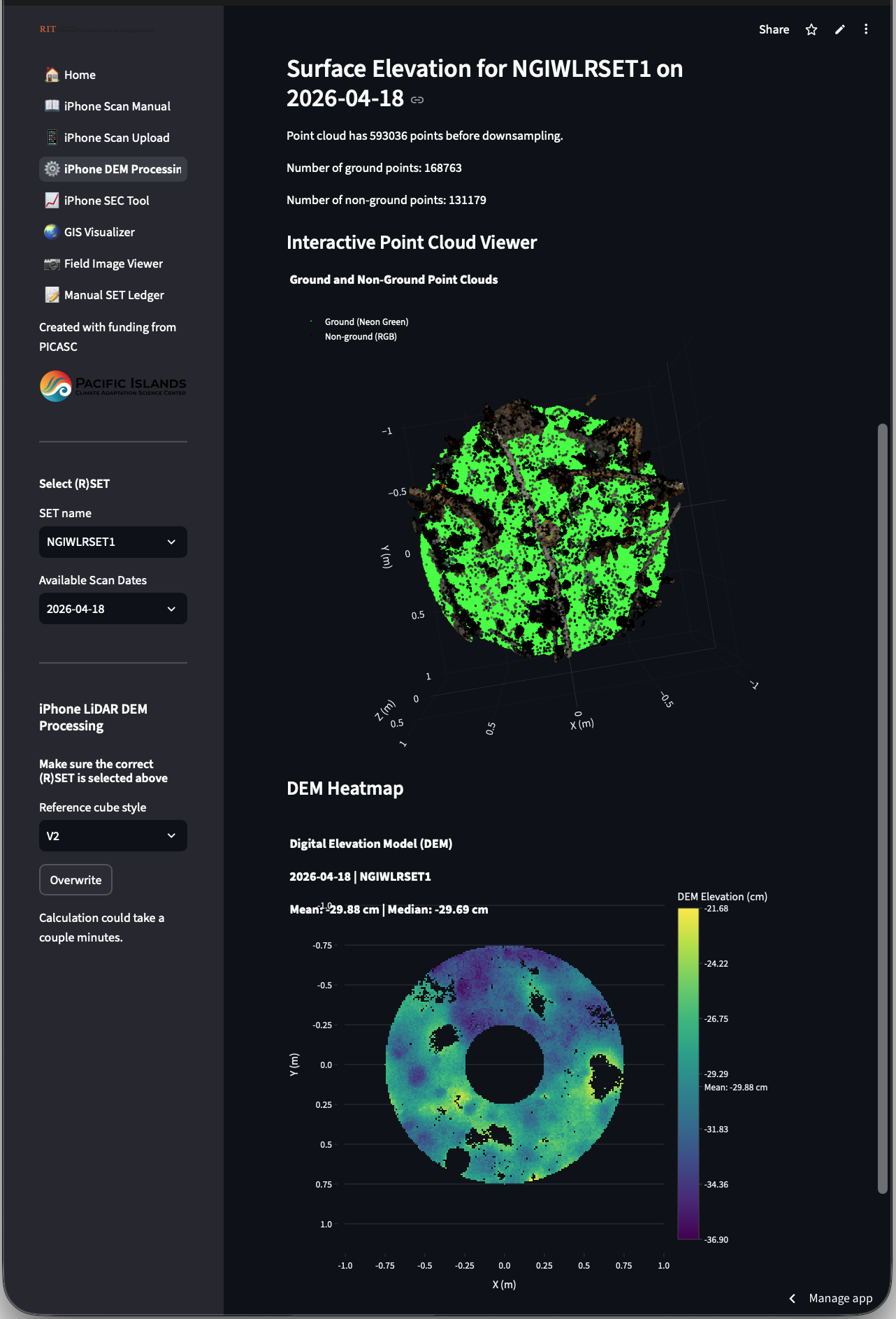
An example scan processed with the iPhone LiDAR SET web application.
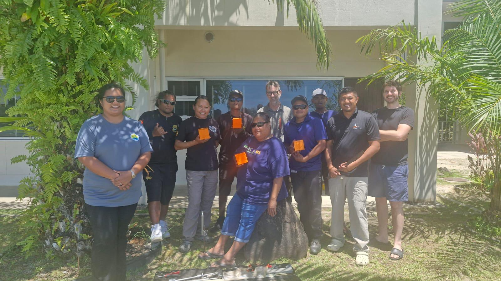
Rangers from Palau's Protected Area Network met with Rich MacKenzie & Rob Chancia for a Pacific Mangrove Monitoring Network workshop on April 28, 2026 in Koror, Palau.
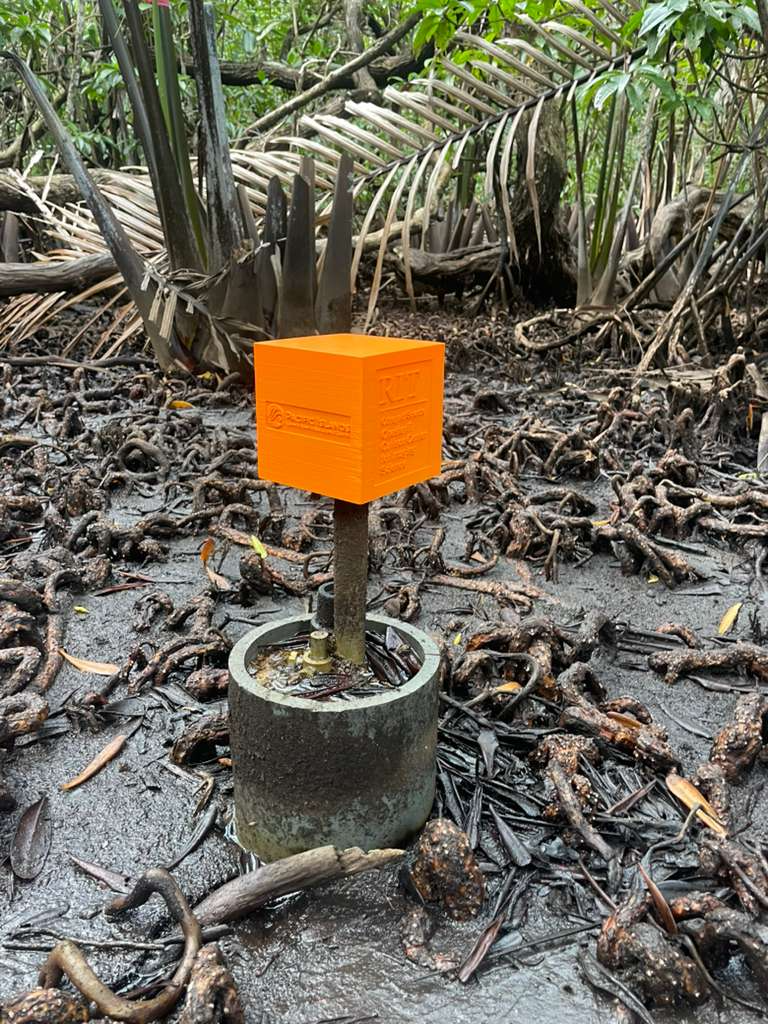
RIT orange surface elevation table reference cube for iPhone LiDAR scanning.