Through the Perspective of LiDAR: A Label-Efficient Pipeline for TLS Segmentation
Principal Investigator(s)
Jan van Aardt
Research Team Members
Fei Zhang
Rob Chancia
Josie Clapp (Undergraduate Student)
Dimah Dera
Amirhossein Hassanzadeh
Project Description
This project develops a label-efficient pipeline for semantic segmentation of terrestrial laser scanning (TLS) point clouds, addressing the high cost of manually labeling complex 3D data. The approach projects 3D scans into structured 2D spherical maps, enriches them with LiDAR-derived features, and uses ensemble learning and uncertainty estimates to focus human annotation on ambiguous regions before transferring the results back to 3D. The pipeline was used to create Mangrove3D, a labeled TLS dataset for mangrove forests, and was evaluated across multiple forest and urban datasets. The research has been completed and published in the ISPRS Journal of Photogrammetry and Remote Sensing, with the dataset, source code, visualization tools, and project materials made publicly available at https://fz-rit.github.io/through-the-lidars-eye.
Figures and Images
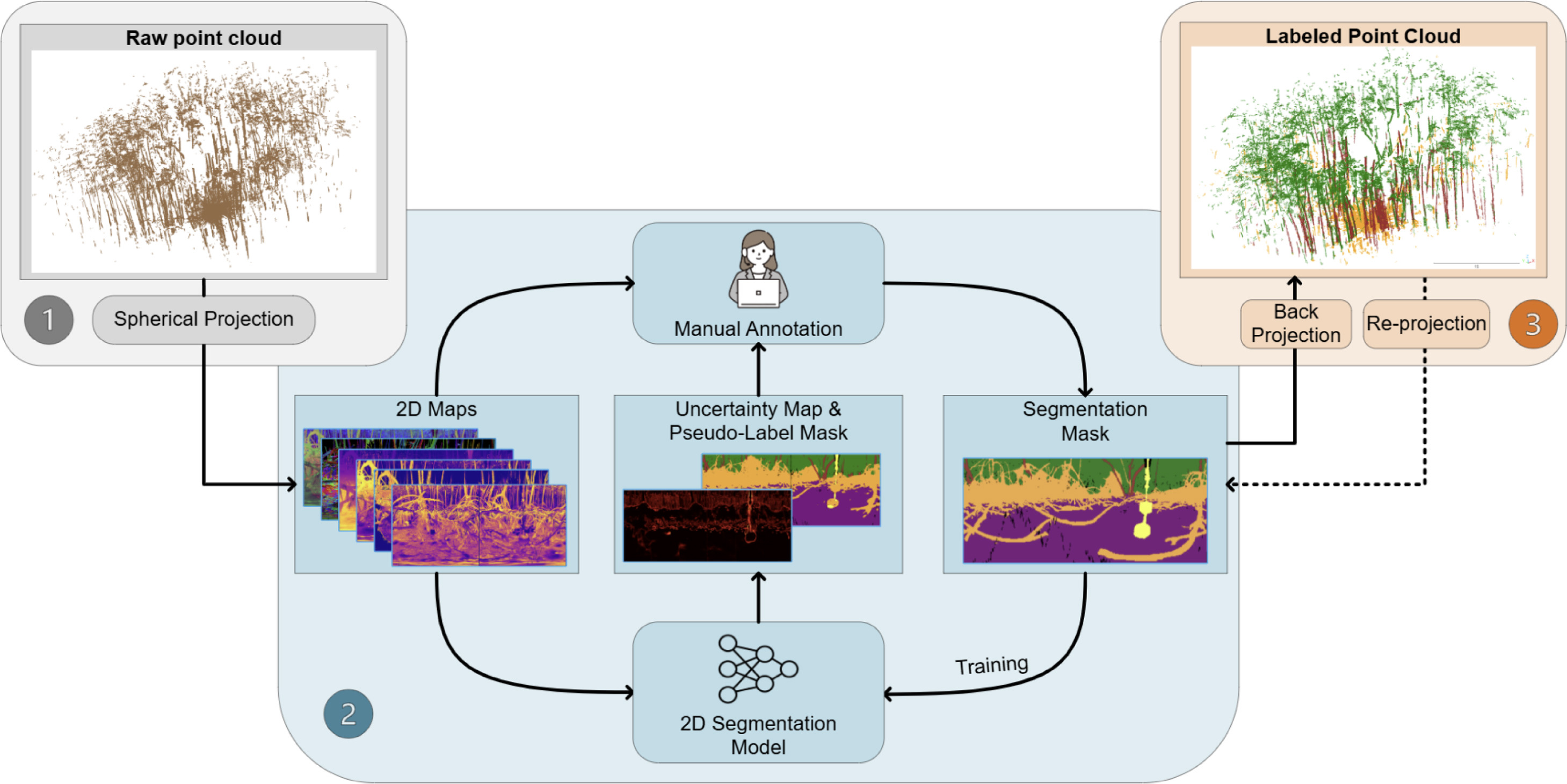
Three-stage workflow for label-efficient TLS point-cloud segmentation: 3D scans are projected into 2D feature maps, annotated using uncertainty-aware ensemble learning, and mapped back to 3D for refinement. The final outputs include a labeled 3D point cloud and a refined 2D segmentation map.