Simultaneous Localization and Mapping
Simultaneous Localization and Mapping (SLAM) uses observations to construct a graph, which often contains both environments (mapping), and robot trajectories (localization).
RoCAL focuses on building precise and robust graphs, through improving feature detection and data association reliability, adapting to environmental changes, and collaborative mapping.
Feature Detection
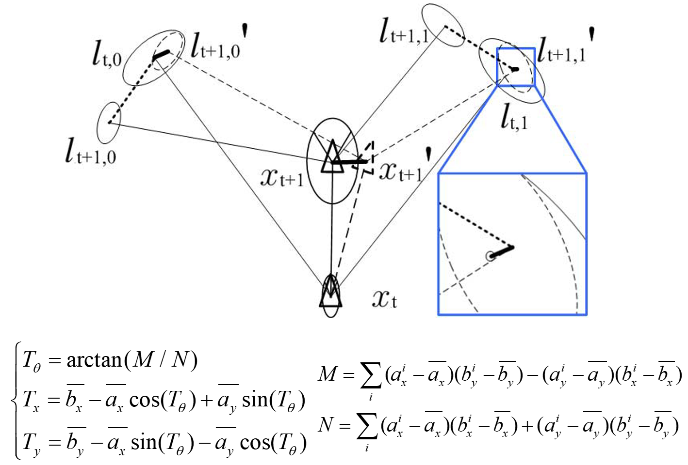
Feature detection is critical in SLAM, but is also tricky because different environmental structures and different sensors often require different feature extractors. We developed various LIDAR feature detectors, which can be applied to virtually any environments, because SLAM algorithms should have zeros assumptions on environments.
Multi-Scale General Purpose Feature Detection
Structure Tensor LIDAR Feature Extraction
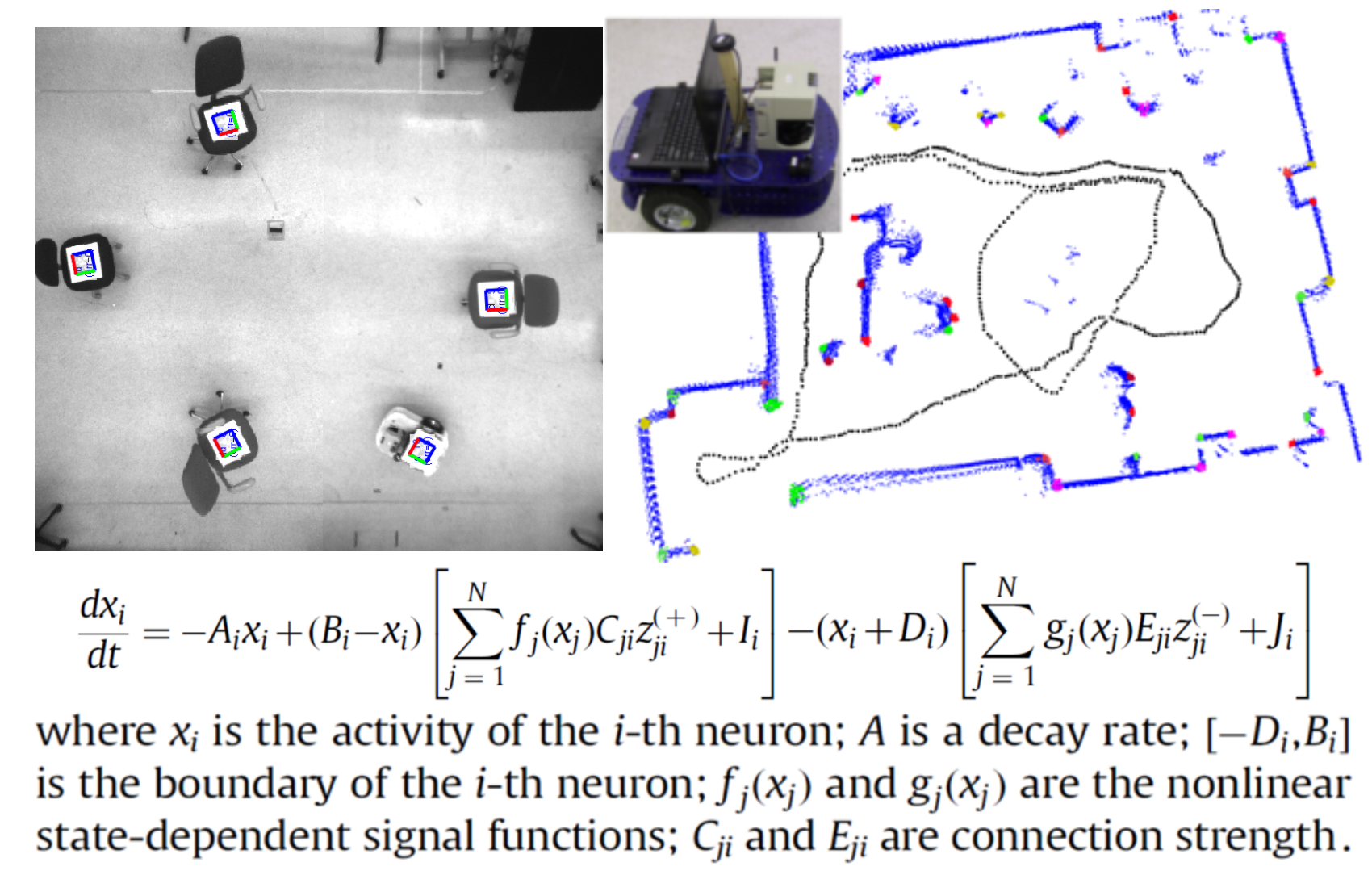
Data Association
Data association finds the correspondence between two sets of observations, or between an observation set and the map landmarks. Wrong associations generate incorrect links or false nodes in the SLAM graph, while missing associations omit the links. Therefore, reliable data association algorithms are critical to SLAM systems, especially when the environmental ambiguity is high.
We utilizes the conditional independence between observations given the robot movement to improve the precision and the computational efficiency for joint compatibility test.
Algorithms
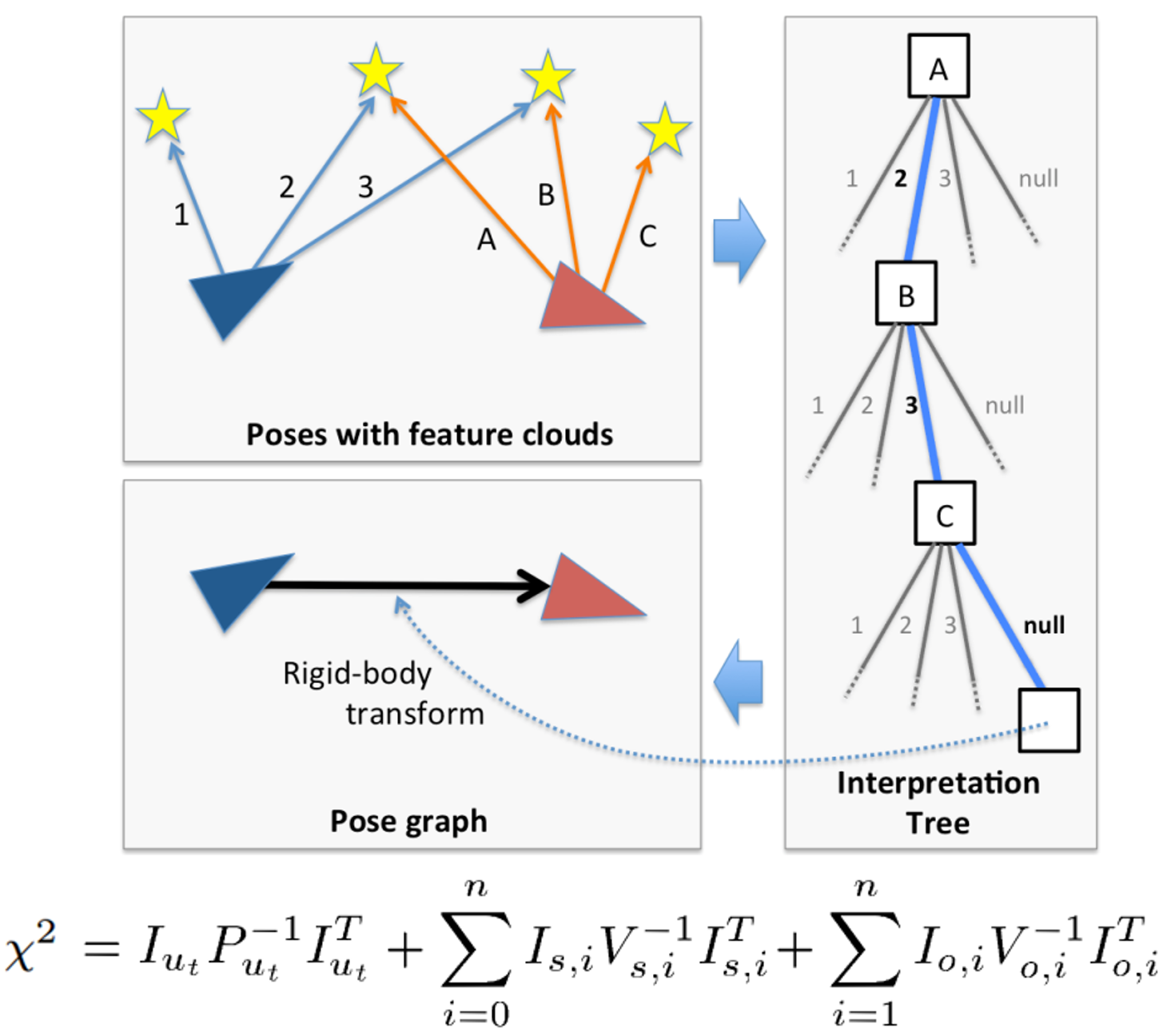
Incremental Joint Compatibility Test (O(N2) Complexity)
Fast Joint Compatibility Test (O(N) Complexity)
Performance
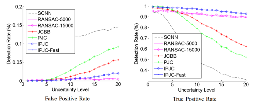
Precision
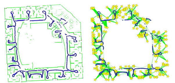
Results
Collaborative Exploration and Mapping
We further extend the SLAM system for multi-robots collaborative exploration and mapping.
This is a team work led by Prof. Edwin Olson, which is part of the work of Team Michigan for the Multi Autonomous Ground-robotic International Challenge (MAGIC).