Global surveillance augmentation using commercial satellite imaging systems
Principal Investigator(s)
John Kerekes and Andreas Savakis
Research Team Members
Jobin Mathew, Navya Nagananda, Bryan Blakeslee, Jared Van Cor, Scott Brown
Project Description
This project is aimed at developing an automated software system to ingest commercial satellite imagery and automatically detect the presence of certain objects or changes. RIT has been supporting this project with several tasks.
- Image Chip Simulation – We have been using DIRSIG to simulate commercial satellite imagery of various objects for use in training deep learning algorithms to perform object detection.
- Multispectral Change Detection Algorithm Evaluation and Development – We developed a Python toolbox for change detection evaluation and implemented a number of state-of-the-art algorithms for evaluation. The figure below presents an example change detection pair and a screen shot of the toolbox interface.
- Unstructured Change Detection with Class Agnostic Region Proposals – We investigated the use of region proposals to detect unstructured changes in image pairs.
- Unstructured Change Detection with LambdaNet – We also investigated the use of the LambdaNet neural network architecture to detect unstructured changes in image pairs.
Project Status:
During 2018-19 we initiated a 4-year follow-on Phase III program with Kitware/AFRL which will further develop and implement the ongoing tasks of image simulation and algorithm development.
Figures and Images
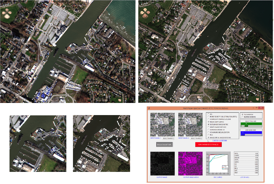
Example WorldView-2 RGB change detection pair with zoom image and Python toolbox interface.