Improving estimates of salt marsh resilience and coastal blue carbon
Principal Investigator(s)
Christy Tyler and Charles Bachmann
Research Team Members
Gregory Badura, Rehman Eon, Christopher Lapszynski, Sarah Goldsmith
Project Description
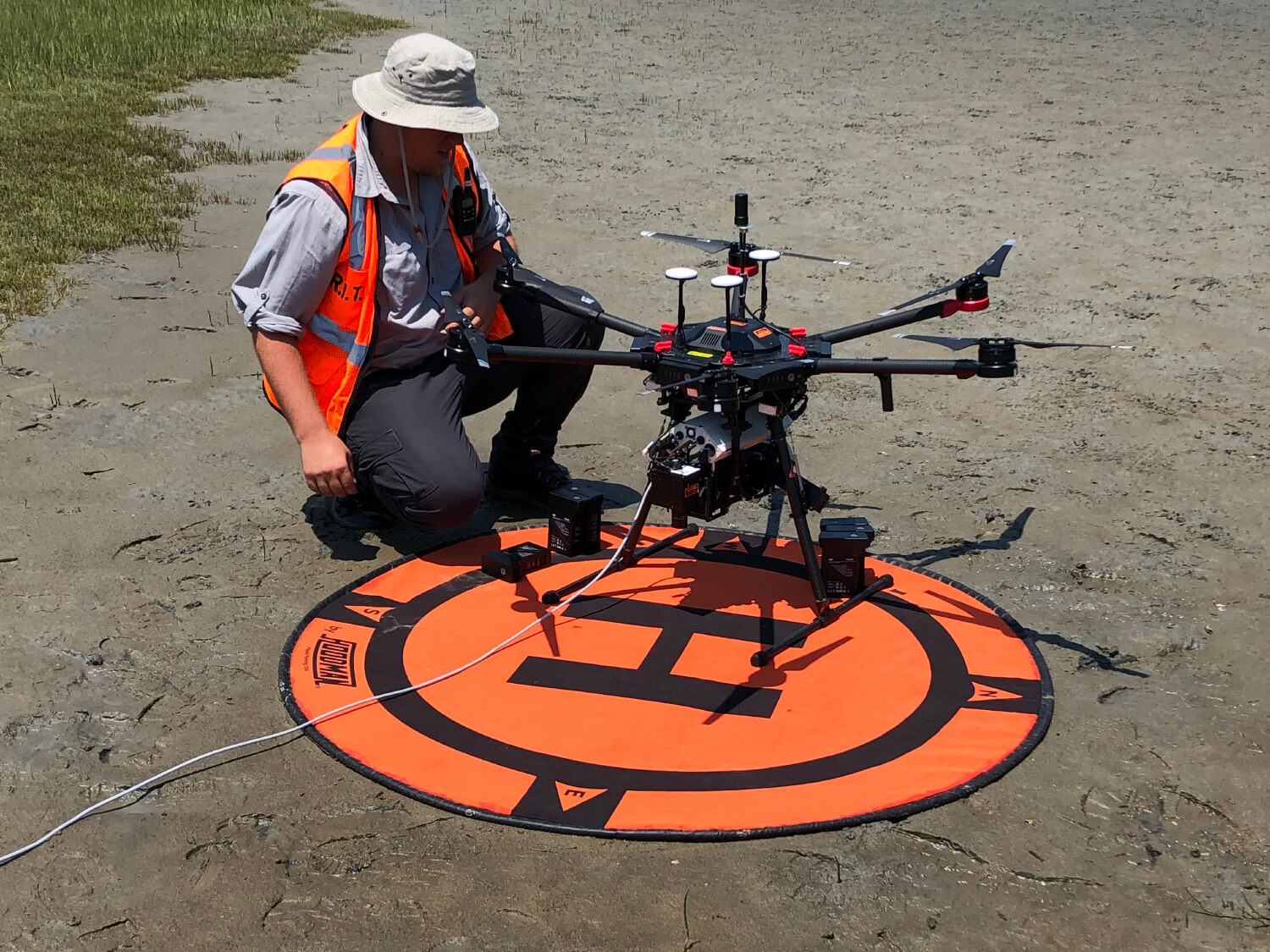
This project focuses on the development of more reliable estimates of carbon storage in coastal wetland systems. The goal is to use very high-resolution hyperspectral remote sensing imagery and detailed surface models from LiDAR and stereo RGB imagery in combination with highly detailed contemporaneous biophysical ground truth data to construct more accurate assessments of carbon storage in salt marsh and to scale these results to imaging platforms with lower spatial resolution such as satellites and fixed-wing aircraft. Using the mast-mounted hyperspectral imaging system developed by Dr. Bachmann, his students, and staff as well as imagery acquired by the MX-1 drone system, Dr. Tyler, Dr. Bachmann, and their students have conducted a number of imaging and ground truth data collection campaigns at the Virginia Coast Reserve (VCR) Long Term Ecological Research (LTER) site. The imagery collected emphasizes these very fine spatial scales which are typically providing hyperspectral imagery in some cases at mm to cm spatial resolution. In addition to extensive field data collection and validation, salt marsh specimens have been brought back to RIT and are used with the GRIT-T hyperspectral goniometer in Dr. Bachmann’s laboratory to further develop and improve models.
Project Status:
Imagery collected of a marsh chronosequence by the team using the mast-mounted hyperspectral system at the VCR LTER site has now been used to retrieve salt marsh biomass from this very fine spatial resolution (Figure Z.Z) and validated using ground truth data collection on site. These initial results were recently published in a Special Issue of the journal Remote Sensing with examples provided in Figure Z.Z for marshes of varying ages. The site is a perfect laboratory for understanding carbon storage as a function of marsh age because the marsh chronosequence on Hog Island, VA, where the imagery was acquired, has marshes ranging from in age from 1 to 150+ years. The MX1 has been used to develop high-resolution models of the surface and canopy from the onboard LiDAR and high-resolution stereo imagery; these data will provide a critical means of extending the validation effort across a much broader spatial scale. In addition, our laboratory analyses relating vegetation indices such as leaf area index (LAI) to the angular dependence of spectral response using the GRIT-T hyperspectral imagery as well as three-dimensional canopy models was recently published in the IEEE Journal of Selected Topics in Applied Earth Observations and Remote Sensing.
Figures and Images
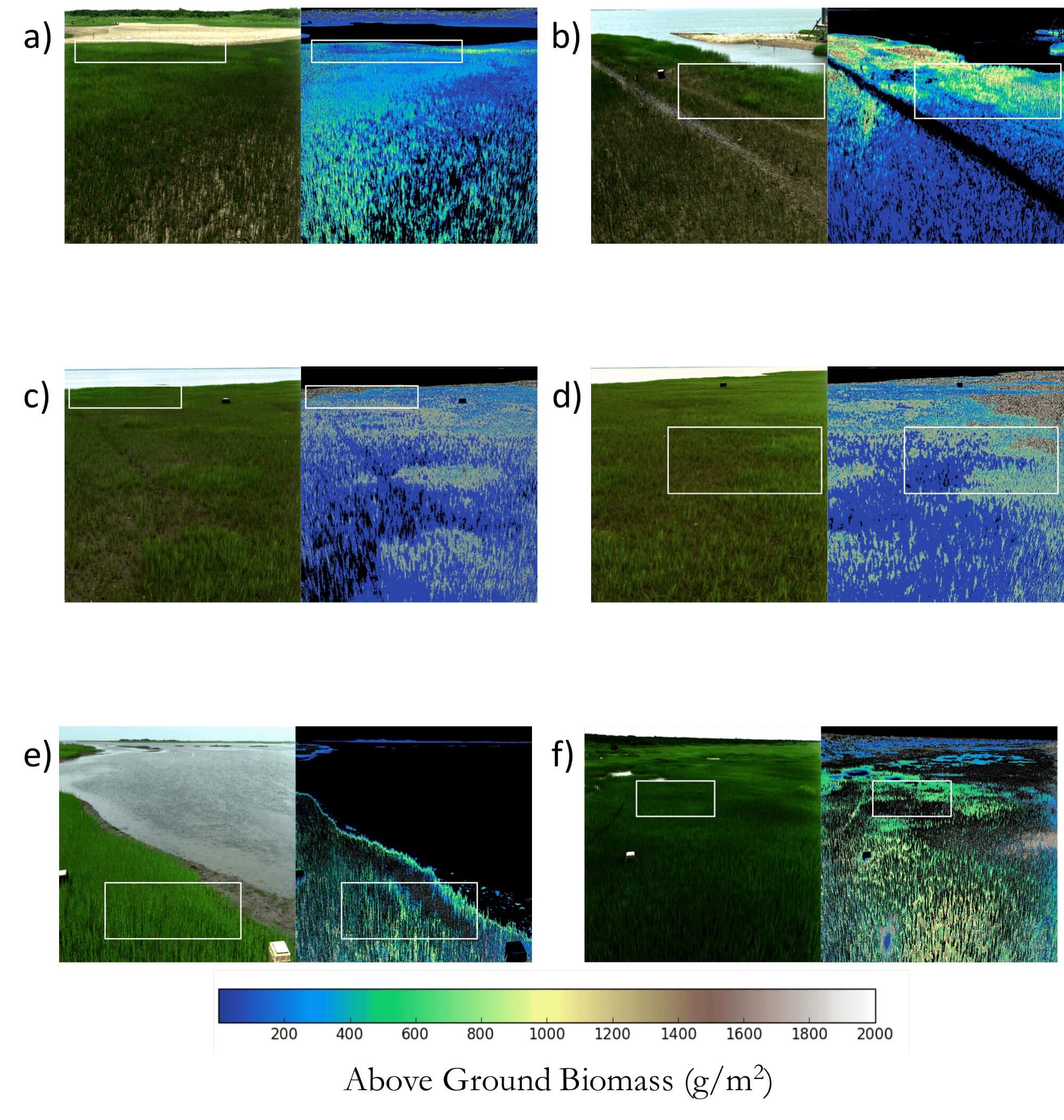
Hyperspectral scenes (left image in each pair) and corresponding retrieved above ground biomass (g/ m2) (right image in each pair) for marshes of various age from our hyperspectral imaging mast-mounted sys- tem (far left): (a,b) 1850; (c,d) 1974;and (e,f) 2011
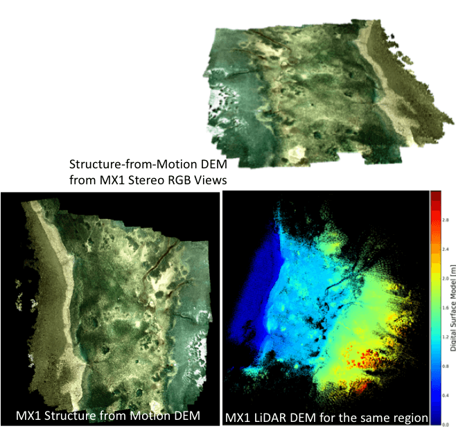
MX1 LIDAR and structure-from-motion results from flights at this site. MX1 hyperspectral and thermal imagery was also collected.