Simulation and Modeling to support Definition of Sustainable Land Imaging System Requirements
Principal Investigator(s)
Aaron Gerace
Research Team Members
Rehman Eon, Tania Kleynhans, Matthew Montanaro
Project Description
The Sustainable Land Imaging (SLI) program is committed to extend the nearly fifty-year data record of space-borne measurements of the Earth’s surface collected from Landsat’s reflective and thermal instruments. Through the development of a system of space-borne sensors, and perhaps the inclusion of alternative data sources, the SLI program is interested in identifying cost-effective solutions to acquiring consistent and continuous data to support science applications related to the monitoring of Earth’s natural resources. To support these interests, the Rochester Institute of Technology (RIT) is performing simulated trade studies that investigate the impact of potential system requirements on various science applications.
This project aims support the definition of requirements for future Landsat thermal instruments in retrieving accurate land-surface temperature, which represents a key input parameter to several science applications (e.g., estimation of evapotranspiration, drought monitoring). As such, RIT conducted simulated studies to identify the optimal number, shape and placement of Long Wavelength Infrared (LWIR) bands, which will help minimize errors in the surface temperature retrieval process. In these studies, RIT looked at the performance of two temperature retrieval algorithms in determining requirements for future Landsat thermal instruments; (1) split-window and (2) temperature/emissivity separation. We also developed a TES-driven SW algorithm to assess the potential for improving surface temperature estimations using a hybrid approach.
Figures and Images
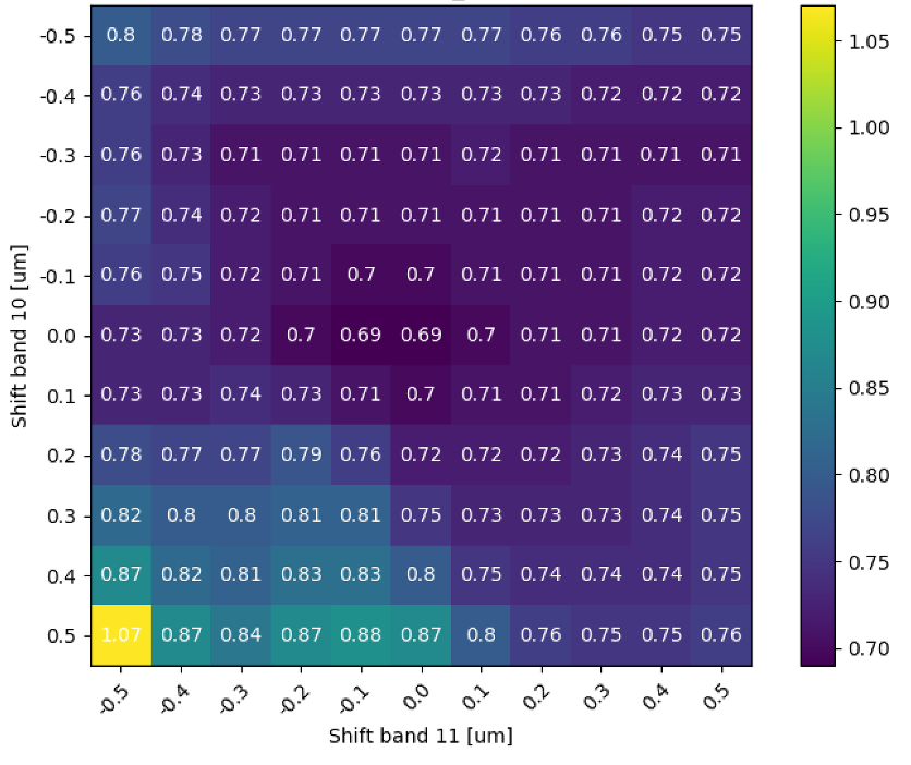
The root-mean squared error (RMSE) in the retrieved temperature from the split window algorithm by shifting of the nominal Landsat TIRS bands.
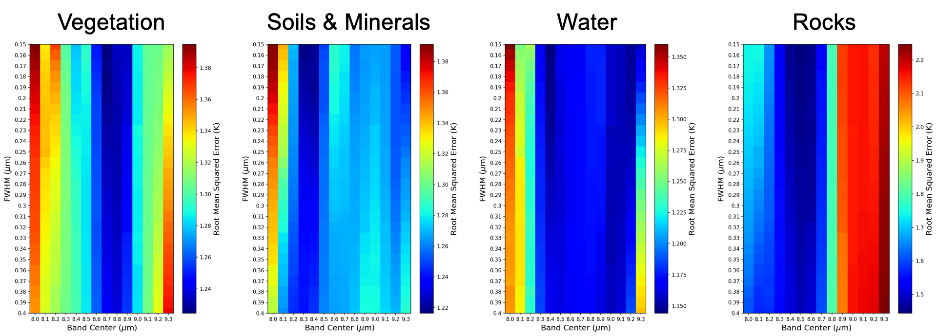
The RMSE in the retrieved temperature using the TES algorithm for the optimal third band when the two bands are the nominal Landsat TIRS bands for the four material classes.
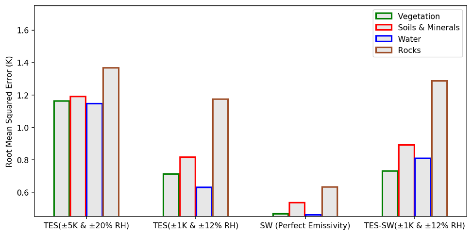
Comparing the temperature RMSE for the TES, SW and TES-SW hybrid algorithm for 5-band imaging system.