Support to USGS Enhance Calibration and Validation for Current and Future Landsat Thermal Instruments
Principal Investigator(s)
Aaron Gerace
Research Team Members
Tania Kleynhans
Project Description
Several Split Window (SW) algorithms have been successfully applied to infrared satellite data (e.g. MODIS, VIIRS) for the estimation of land surface temperature. This research focuses on creating a Split Window algorithm for the Thermal Infrared Sensor (TIRS) onboard Landsat 8. Results are compared to the current Single Channel surface temperature method and in-situ validation sites. These sites include the SURFRAD network as well as ocean buoy measurements (NOAA) and Lake Tahoe and Salton Sea buoys (JPL). Results of this study are provided to the Unit ed States Geological Survey (USGS) to support their goals of releasing a validated land-surface temperature product to users.
In preliminary studies, the SW LST performed slightly better than the SC method to estimate LST using a combination of SurfRad validation sites and buoys as ground reference points. Changes to the SW algorithm to compensate for aliasing appearing when difference terms are calculated, has been added and is described in the Remote Sensing Article Towards an Operational Split Window-Derived Surface Temperature Product for the Thermal Infrared Sensors Onboard Landsat 8 & 9. A SW uncertainty product has been developed to inform users of the accuracy of the SW LST data. The SC method will be released in collection 2, and studies are underway to validate final results before release. This involves comparisons with additional reference data, as well as SW results.
Figures and Images
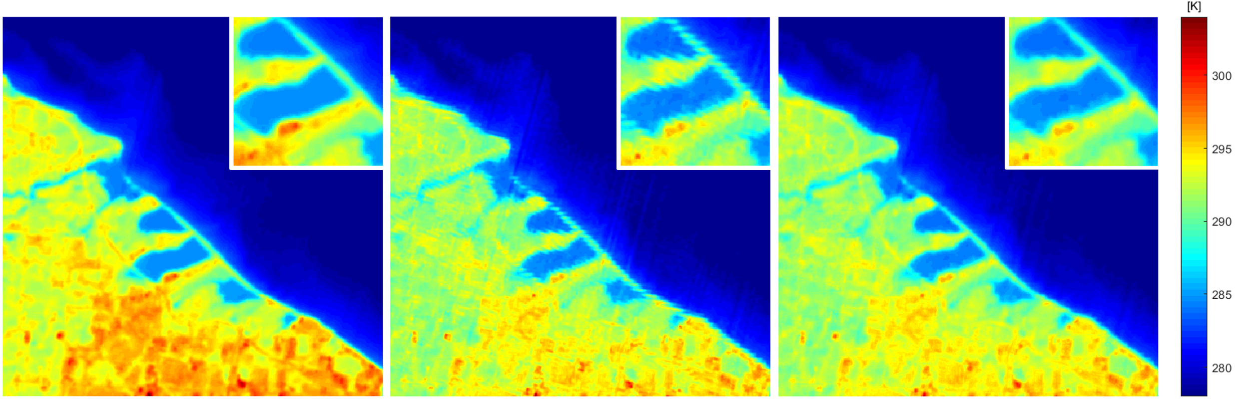
Figure 1: Comparison of surface temperature products: Single channel product (left), the nominal split window product (middle), and the proposed split window product (right) (Landsat scene ID:LC08_L1TP_016030_20190413_20190422_01_T1).