The use of sUAS sensing for duck nest detection
Principal Investigator(s)
Jan van Aardt
Research Team Members
Matt Helvey, Carl Salvaggio
Project Description
The objective of this research is to assess the feasibility of using, in order of priority, remotely captured thermal infrared, LiDAR, hyperspectral, and RGB imagery to detect and classify duck nests in the Pothole Prairie region, North Dakota. Natural resources such as ducks and wildlife are vital to North Dakota, bringing in more than 21 million visitors and 3 billion dollars in revenue annually. 50-80% of all North American ducks are born in the Prairie Pothole Region which ranges from Canada down through Montana, the Dakotas, Minnesota, and finally, Iowa. The Prairie Pothole Region is shrinking, losing approximately 50,000 acres every year. It is important that we can accurately assess the duck populations as well as the environment they thrive in so that we can understand the impacts of industrial development, conservation efforts, and population management techniques.
The current method for locating duck nests is to drive two ATVs with a chain between them that is dragged through the wetlands to scare up the hens, giving away the location of the nests. A quicker and less invasive method would be to use imagery obtained from Unmanned Aerial Systems to detect these nests remotely. In partnership with the University of North Dakota and Ducks Unlimited, MS student Matthew Helvey and the RIT drone team deployed to Coteau Ranch, ND, for a weeklong data collect. Approximately 30 flights were conducted during the trip to obtain remotely sensed thermal, RGB, hyperspectral, and LiDAR imagery of duck nests and the surrounding environment. Next steps involve processing the data from the trip to extract training and testing data for nest detection algorithm development.
Figures and Images

The detection of duck nest via sUAS sensing would enable researcher and wildlife managers to assess duck populations. remotely, extensive-
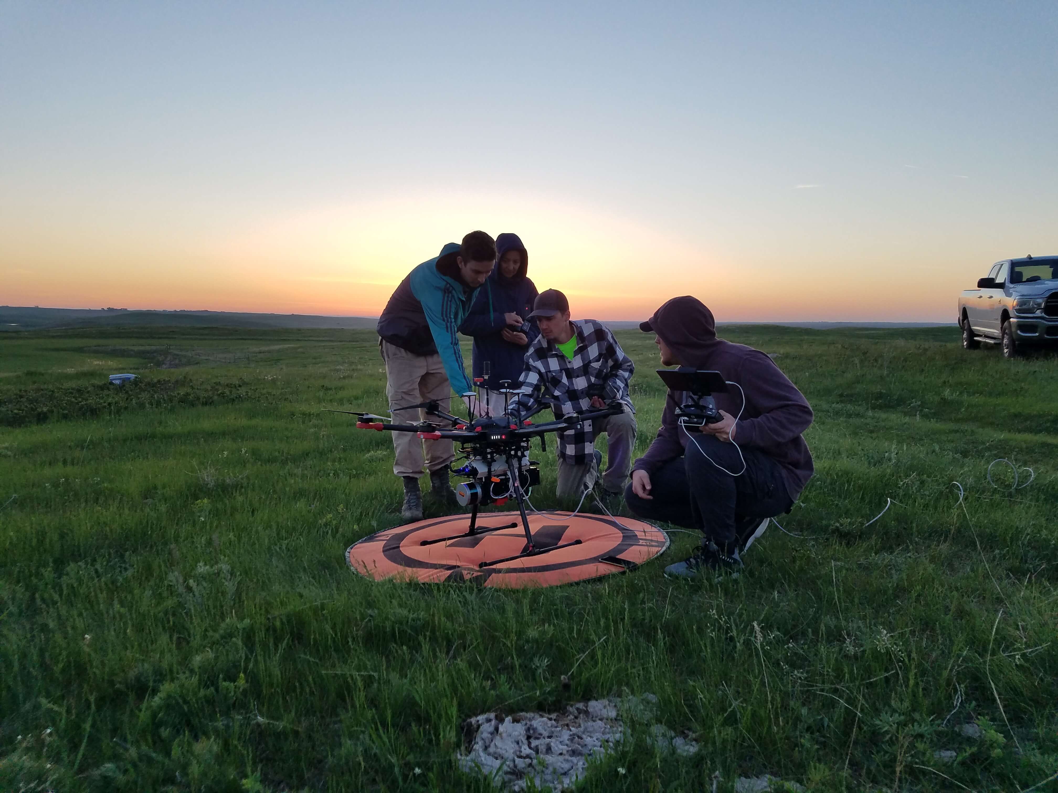
The RIT sUAS team deployed to North Dakota to collect thermal imagery during dusk scenarios to ensure high-contrast