The use of terrestrial laser scanning for structural assessment of complex forest environment
Principal Investigator(s)
Jan van Aardt
Research Team Members
Ali Rouzbeh Kargar
Project Description
Assessing crop health and, moreover, predicting crop yield from remote sensing imagery is an ongoing area of interest in precision agriculture. We thus pursue a unified spectral-structural model of the growth and development of corn (Zea mays L.) which considers spatiotemporally-varying environmental variables, in pursuit of a theoretically optimal satellite system specification through light-transport simulation with DIRSIG5 (to the right). Our preliminary objective is to assess the fidelity of a virtual corn field in accurately reproducing spectral response of a spaceborne imaging platform. Our overarching objective is to leverage such a simulation-based approach to perform a spaceborne system-level analysis to establish minimum requirements for assessing corn spectral-structural variability and associated yield-modeling throughout the growing season. The outcomes associated with these objectives could contribute to a definitive specification for optimized corn yield monitoring.
Since beginning work on this project in the summer of 2018, i) we have implemented and improved a geometric parameterization of corn canopy present in the literature, ii) we have developed a preliminary continuous-time growth model to drive the geometric parameterization which is based on discrete-time growth models present in the literature, and iii) in partnership with the USDA and the RIT UAS team, we have collected reference data from a USDA site in Beltsville, Maryland, which we will use to validate the accuracy of the growth model. It may also be worth nothing that we have submitted a proposal to the NASA Goddard Space Flight Center as part of the NASA 2019 Fellowship activity seeking support for the continuation of this project. In the short term, PhD student Grady Saunders plans to complete the first publication in the late fall of 2019, which will focus on the development and validation of the simulation-based approach.
Figures and Images
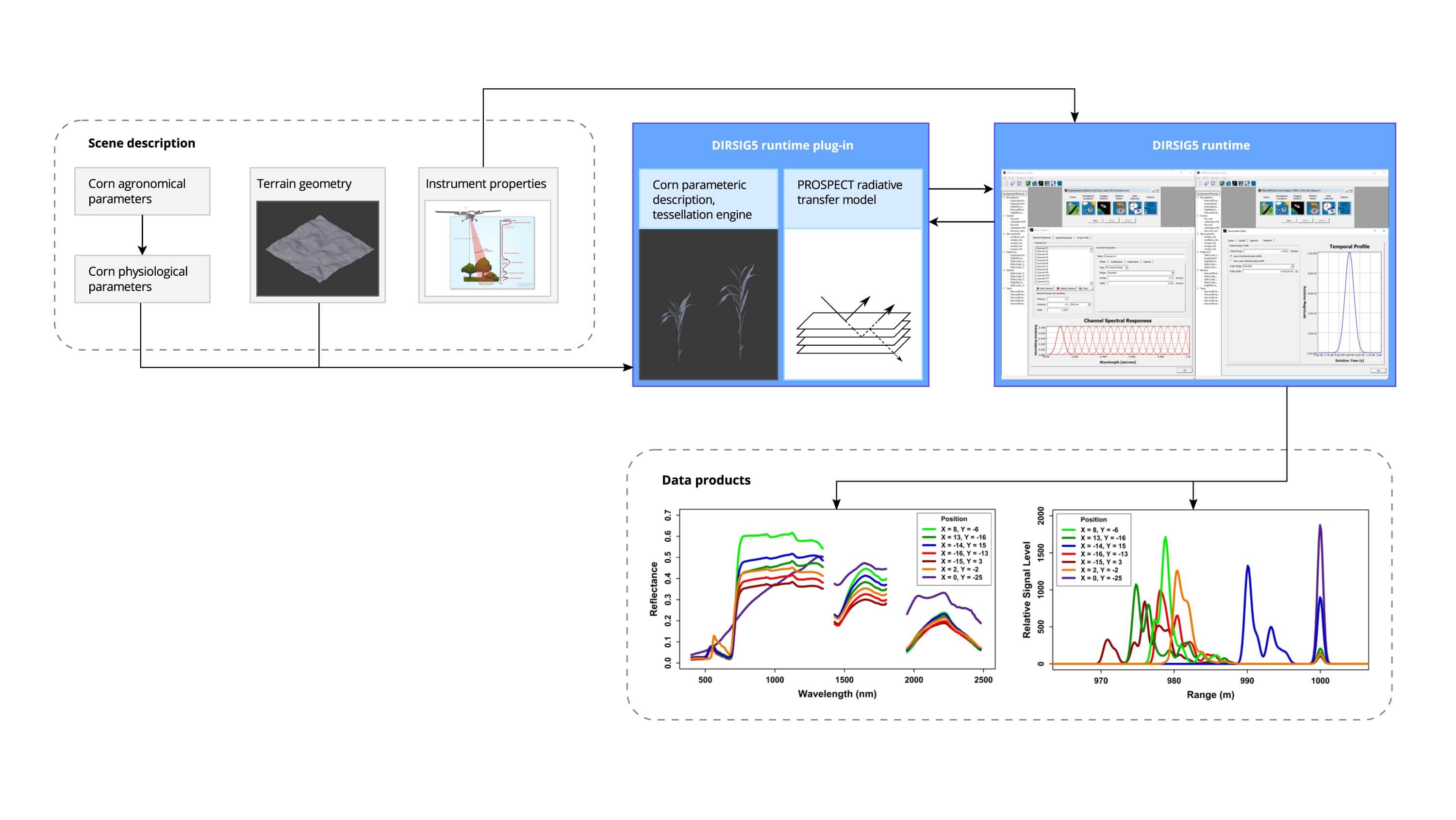
A workflow that demonstrates the use of DIRSIG5 to model the spectral phenology of corn fields, toward identifying satellite sensing needs to assess corn yield at coarse scales.
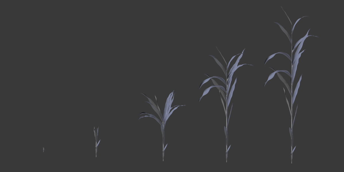
An example of 3D corn plants, as grown through time, to establish a biophysically-correct version of a corn plant.
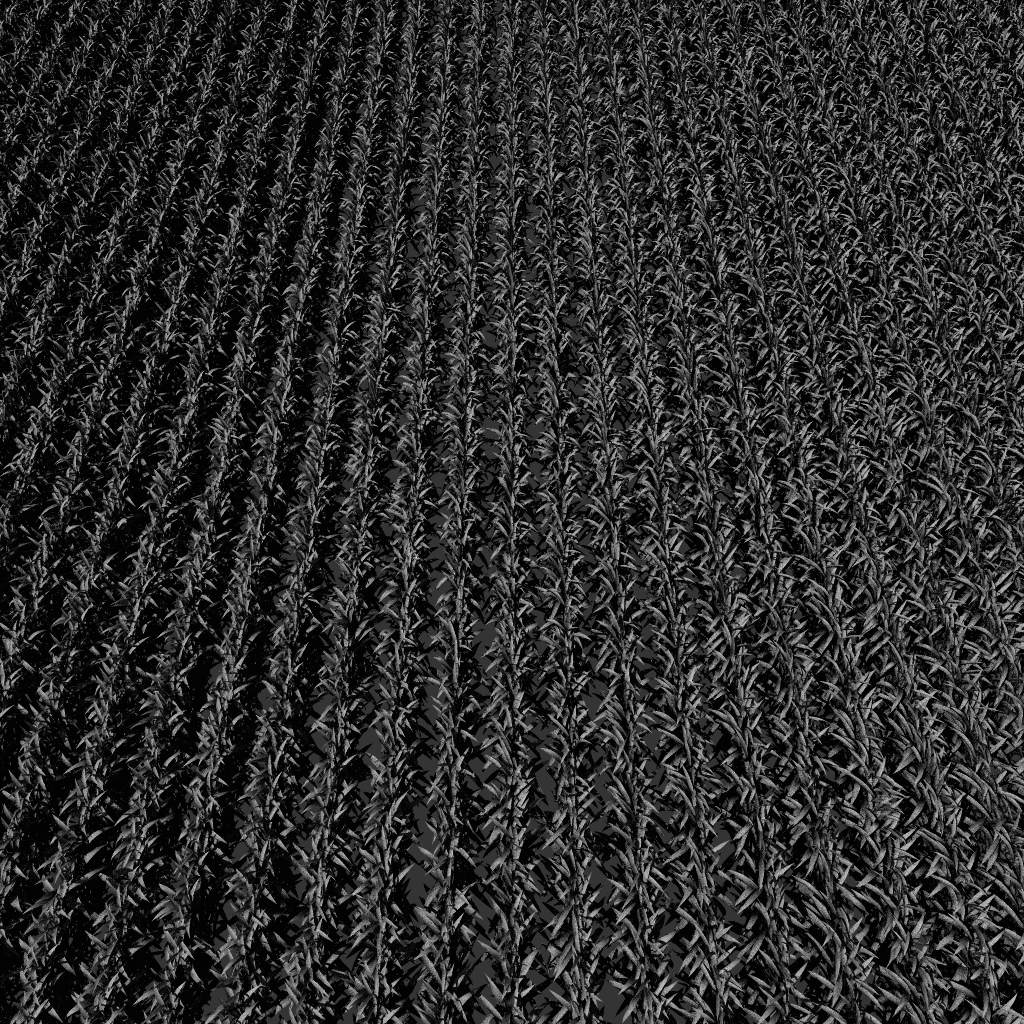
These 3D corn plants then can be randomized to simulate a complete corn field, with the proper structural, spectral and associated biochemical.