Yield forecasting and harvest maturity assessment via sUAS platforms
Principal Investigator(s)
Jan van Aardt
Research Team Members
Amirhossein Hassanzadeh, Fei Zhang
Project Description
The two objectives of the research – yield modelling and harvest scheduling- have undergone extensive research over the past year. An RIT-based greenhouse study during winter and spring of 2019 resulted in insightful results regarding both yield and harvest of snap-bean, as a proxy crop. PhD student Amir Hassanzadeh collected high-temporal frequency spectroradiometer data (400-2500 nm) for 48 snap bean plants over the course of a full growing season; this took place using a controlled-environment set-up, thus enabling collection of spectra under a best-case scenario (figure to the right). Our results for the harvest maturity objective show that one could classify based on spectra, as well as spectral and physical attributes between ready-to-harvest and not-ready-to-harvest plants with 76% and 80% accuracy, respectively. For the yield modelling objective, our results from partial least square regression depicts that the best time for yield prediction is 20 days prior to harvest. We aim to investigate harvest modelling and yield scheduling of the snap bean crop of six different cultivars located at a research farm, in Geneva, N.Y. (maintained by our collaborators in Cornell University) during the summer of 2019.
The goal is to be able to deliver operational software packages that would output easy-to-interpret harvest and yield probability maps to farmers and growers as a non-labor-intensive and time-consuming approach. Our future work involves using the knowledge from the 2019 drone study and to scale this to a satellite study by simulating satellite imagery with the drone imagery. Currently, two papers revolving around the results from the greenhouse study are being prepared and undergoing final analysis.Moreover, one conference abstract for AGU 2019, San Francisco, will be submitted by July 2019.
This effort is complemented by a sister study that focuses on 3D sensing of crops, with the same ultimate operational objectives. This study is predicated on the assumption that UAS-based tools can be used to meet the farmers’ need for enhancing crop productivity and yield. By utilizing imaging sensors carried by drones, we aim to extract structural information of crops via 3D points cloud, created by structure-from-motion (SfM) of RGB images and by light detection and ranging (LiDAR), and then create effective structure-based models to evaluate crop yield and/or disease risk. The specific objectives of PhD student Fei Zhang’s work are to; i) Assess the utility of 3D points clouds from both from SfM and LiDAR, to generate digital elevation and crop (plant) models (figure to the left); ii) Evaluate the usefulness of structural information of crops for models, by retrieving parameters such as canopy height, leaf area index (LAI), canopy density, canopy gap probability (Pgap), normal distribution, etc.; iii) Determine of such models of crop yield and disease risk are stable through time; and iv) Determine if there is any benefit of using one sensing modality - SfM vs. LiDAR – over the other.
Figures and Images
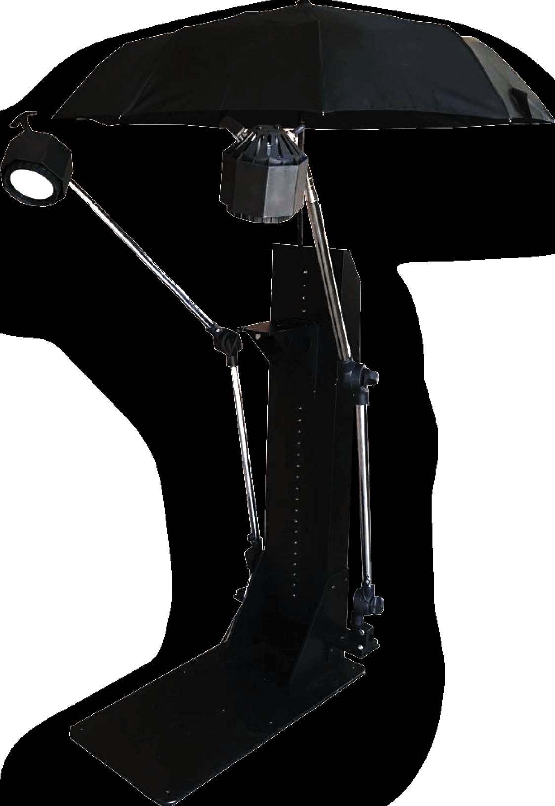
An example of the setup used to collect spectroradiometer data for 48 snap bean plans in a greenhouse during winter 2019; this setup enabled reduction of external illumination sources, as well as minimization of background (soil) impacts.
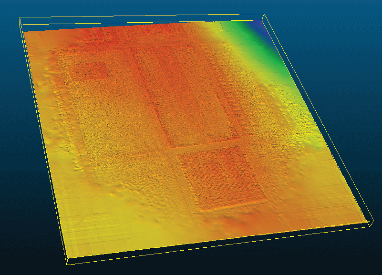
An example of a digital elevation model of a snap bean field, based on interpolation via kriging of sUAS LiDAR data.