Landsat Image Systems Support
Principal Investigator(s)
Research Team Members
Project Description
NASA Goddard Space Flight Center, U.S. Geological Survey (Earth Resources Observation and Science Center) Project Description and Status: This project provides science systems engineering support for the NASA Landsat program. The PI serves as the deputy instrument scientist for the Landsat Next project which involves being an interface among the instrument vendor, NASA, and USGS project teams for science-related requirements. Team members ensure that raw pixel data from the detectors are properly recorded, processed, compressed, downlinked, verified, and calibrated on the ground. The PI also serves on the Landsat Calibration/Validation team and is responsible for continuing on-orbit characterization and calibration of the Landsat 8 / Thermal Infrared Sensor (TIRS) and the Landsat 9 / Thermal Infrared Sensor 2 (TIRS-2) instruments. Team members also provide technical expertise and guidance on Landsat instrument technology development.
Over the past year, the PI has been primarily involved in establishing relationships with the newly selected vendor for the Landsat Next Instrument Suite (LandIS). This work involves reviewing science requirements with the vendor team and helping to determine if requirements need to be modified to fit the instrument architecture. The PI is also involved with ensuring the onboard compression algorithm will be implemented as intended to ensure all science data will be downlinked successfully. Team members generate models and datasets to support these efforts. The PI continued to support the on-going operations of the TIRS instruments onboard Landsat 8 and Landsat 9 through analyses of in-flight calibration data with the Landsat Cal/Val team and by assisting the Flight Operations team with recovering from instrument anomalies.
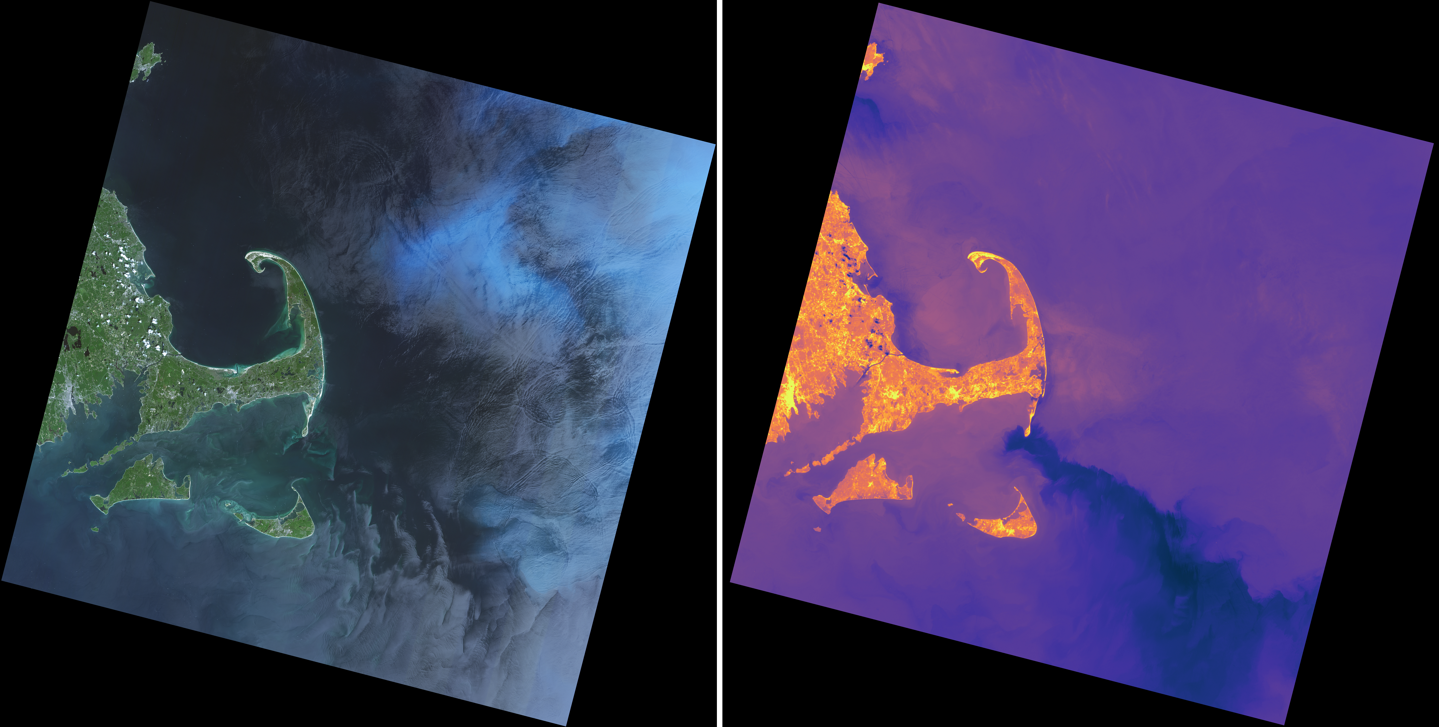
Figure 1: Images of a plankton bloom off the coast of Cape Cod, MA acquired by the Landsat 9 instruments, OLI-2 (left, in natural color) and TIRS-2 (right, in thermal false color). The contrast of the natural color image was enhanced to bring out details in the water. The false color thermal image is stretched between temperatures of 273K (purple) and 297K (yellow). Image width is 185 km with an image pixel resolution of 30 meters. North is straight up. Acquired on 2025-06-21.
References
[1] Eon, R. S., De Groot, C., Pedelty, J. A., Gerace, A., Montanaro, M., Covington, R. K., DeLisa, A. S., Hsieh, W.-T., Henegar-leon, J. M., Daniels, D. J., Engebretson, C., Crawford, C. J., Holmes, T. R., Dabney, P., and Cook, B. D. Toward a near-lossless image compression strategy for the nasa/usgs landsat next mission. Remote Sensing of Environment 329 (2025), 114929.