Simulation and Modeling to Support Improved Landsat Next Science
Principal Investigator(s)
Research Team Members
Project Description
This project focuses on the development of a simulated environment to enable an assessment of the impact of Landsat Next sensor requirements on resulting image quality. Specifically, large-scale scenes are being developed, and the Digital Imaging and Remote Sensing Image Generation (DIRSIG) model used, to simulate twenty-six band proxy data for the Landsat Next Instrument Suite (LandIS) sensors to help inform requirements. The first two years of this effort focused on developing an automated workflow that generates scenes that are approximately 200x200km in scale to support the simulation of a full Landsat WRS-2 (World Reference System) path/row. Figure 1 shows a true-color, Landsat 8 rendering of the Lake Tahoe region that was developed using this workflow. Year 3 of this effort is seeking to expand the spatial scale of this simulated environment to the entire continental US to support cross-calibration & validation studies. Figure 2 shows progress toward this goal and illustrates that .kmz files of entire states can be ingested by our current workflow to generate the DIRSIG files necessary to generate proxy data at scale.
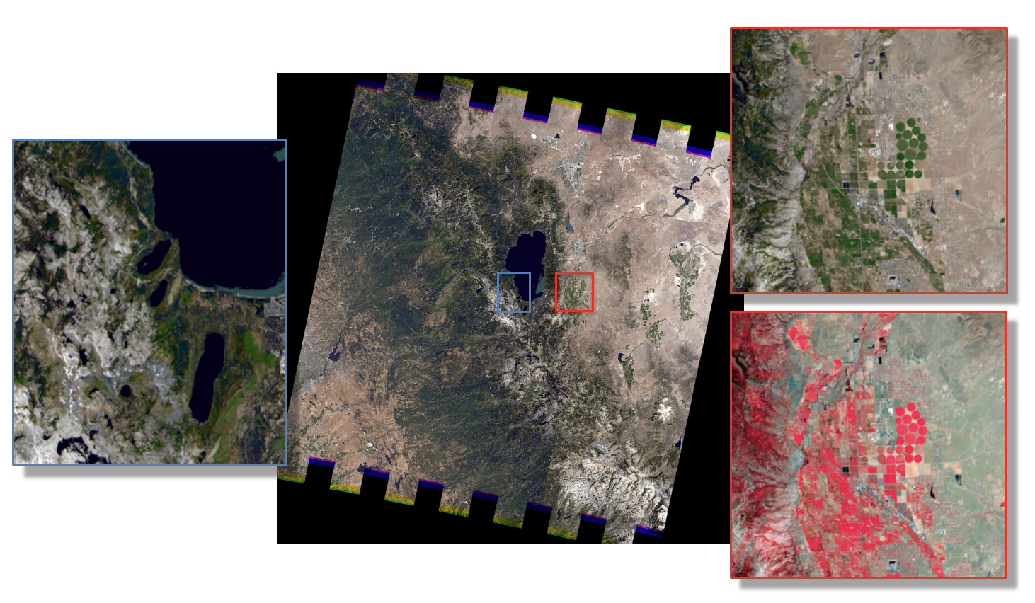
Figure 1: True-color, Landsat 8 rendering of the Lake Tahoe synthetic landscape that was developed to support Landsat Next studies focused on assessing the impact of sensor requirements on image quality. The red zoom windows are included to illustrate the spectral and spatial detail associated with this proxy image data. The blue window is included to indicate the spatial scale of scenes that were historically possible with previous versions of DIRSIG.
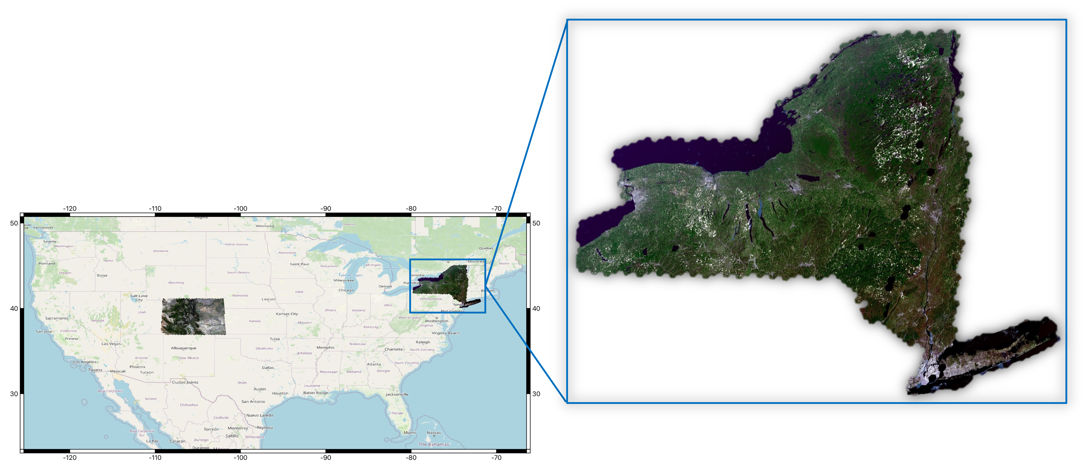
Figure 2: True-color renderings of Colorado and New York State to illustrate progress toward a full Continental US synthetic landscape that is being developed to support Landsat cross-calibration & validation studies. The zoom window of New York is provided to indicate that our current workflow ingests .kmz files to create the (hexagonal) DIRSIG input files necessary to generate proxy data at scale.