RIT researcher receives Department of Energy grant to develop synthetic aperture radar technology
Sandia National Laboratories awards grant to researcher/engineer James Albano for remote sensing projects
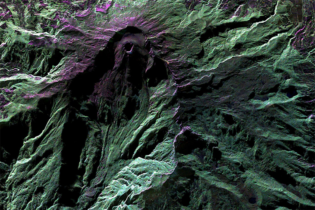
NASA/JPL-Caltech
This false-color image of Colombia’s highly active Galeras Volcano, acquired by NASA’s Uninhabited Aerial Vehicle Synthetic Aperture Radar (UAVSAR) on March 13, 2013, detailed a breached caldera and an active cone that produced numerous small to moderate explosive eruptions. By comparing these camera-like images taken at different times, interferograms are generated that reveal changes in Earth’s surface caused by volcanic deformation. NASA’s C-20A environmental research aircraft carrying the UAVSAR flew the same flight path precisely over the volcano in 2014.
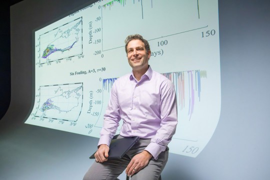
A Rochester Institute of Technology imaging scientist has launched a project funded by the Department of Energy to develop remote sensing technology that could have applications ranging from assessing earthquake damage to determining soil moisture for predicting crop yield. James Albano, ’08 (imaging science), ’14 Ph.D. (imaging science) a researcher/engineer at RIT’s Chester F. Carlson Center for Imaging Science is receiving nearly $180,000 from Sandia National Laboratories to conduct research on synthetic aperture radar (SAR) technology over the next year.
SAR is an imaging radar that operates in the microwave and radio frequency regimes of the electromagnetic spectrum and is able to create two-dimensional and three-dimensional images. While many remote sensing satellites, such as the U.S. Geological Survey’s Landsat, operate at optical or infrared wavelengths, SAR offers distinct advantages.
“Because SAR operates at these lower frequencies of the electromagnetic spectrum, it is able to operate during the day or night and in inclement weather, unlike optical and infrared systems,” said Albano, a member of the Digital Imaging and Remote Sensing (DIRS) Laboratory. “These two advantages give SAR the unique ability to provide continuous surveillance of an area of interest. The difficulty with SAR stems from the idea that the collected data, called raw phase history, is not an image. Only after applying advanced signal processing techniques to the raw phase history is a SAR image formed.”
Albano’s project will look at how automatic target recognition software is affected by SAR image formation algorithms, model fidelity, and how to combine imagery from multiple commercial SAR systems to provide additional information on an area of interest.
The SAR project enters new territory for the Digital Imaging and Remote Sensing (DIRS) Laboratory, which for more than 30 years has focused on developing tools to extract information about the Earth from aerial and satellite imaging systems that operate in the optical and thermal regions of the electromagnetic spectrum. DIRS emphasizes applying science and engineering to solve end-to-end remote sensing problems using a systems engineering approach. This includes designing and developing imaging instruments, developing algorithms to extract information from remotely sensed systems and measurement, and modeling physical phenomena associated with the formation of remotely sensed images. For more information, go to the DIRS website.