Saving lives with digital mapping technologies
Saving lives with digital mapping technologies
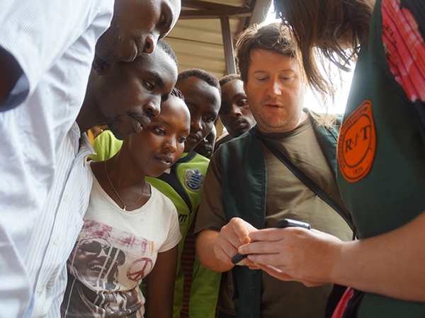
Golisano College professors and students are using geographic information systems (GIS) technologies to help society in a variety of ways. These include international research experiences with Dr. Brian Tomaszewski, who has led teams of faculty and students to refugee camps in Rwanda, where they use GIS to help refugees with natural disasters as part of a National Science Foundation initiative.
As part of this project, “Mapping and Quantifying the Natural Disaster Resilience of Displaced People with the University of Rwanda Center for Geographic Information Systems and Remote Sensing,” Tomaszewski’s team employs persons living in the camp, working with them to establish systems to better identify needs from partner organizations, and help refugees navigate the camp and its resources.
Since 2016, Tomaszewski has also led similar efforts at the Zataari Refugee Camp in Jordan, where he and students work with the mapping team they have helped establish at the camp, assisting refugees of the Syrian Civil War. These efforts are critical to assisting the camp’s more than 82,000 residents, as Zataari gradually morphs from camp to permanent settlement.
In addition, a multidisciplinary team of students and researchers from our School of Interactive Games & Media, employ GIS for educational games that helps players learn how to better protect critical infrastructure against cyber attacks. These efforts have led to the Army Cyber Institute at West Point selecting RIT to develop cyber game for training and education. The game will allow city leaders to learn how multi-sector cyberattacks can affect their city’s critical infrastructure—from the electricity grid to first responders.