Surveying and Geospatial Analysis Option - Environmental Sustainability, Health and Safety BS

Prepare for careers in hazard assessment and emergency planning with the surveying and geospatial analysis option - ESHS BS at RIT.
Overview for Surveying and Geospatial Analysis Option - Environmental Sustainability, Health and Safety BS
Why Pursue RIT’s Surveying and Geospatial Analysis Option in Environmental Sustainability, Health and Safety BS?
Dynamic Courses: Develop your understanding and expertise of Surveying, GIS for Civil Engineering Technology and Environmental Management Systems; and Maps, Mapping and Geospatial Technologies
Career-Launching Co-op: Four semesters of full-time, paid experience that sets you apart in the job market
STEM-OPT Visa Eligible: The STEM Optional Practical Training (OPT) program allows full-time, on-campus international students on an F-1 student visa to stay and work in the U.S. for up to three years after graduation.
The option emphasizes geographic information systems (GIS) and databases that provide critical information for safety and decision-making. The surveying and geospatial analysis option of the environmental sustainability, health and safety BS provides students with hands-on experience using tools to monitor and assess factors affecting the safety of people and the environment. This includes mapping environmental hazards, pollution sources, and potential disaster scenarios such as floods or wildfires. You will learn to apply surveying and geospatial tools to uncover hidden patterns, assess risk, protect ecosystems, support response planning, and minimize community disruption during emergencies.
Courses for Surveying and Geospatial Analysis Option in Environmental Sustainability, Health and Safety BS
Alongside a comprehensive curriculum in environmental sustainability, health, and safety, this BS degree offers specialized courses focused on surveying and geospatial analysis, including:
- Surveying: Introduces surveying fundamentals, including leveling, measurements, traversing, mapping, curves, and earthwork.
- Surveying Lab: Apply surveying techniques in the field using modern equipment for leveling, mapping, curves, and earthwork estimation.
- GIS for Civil Engineering Technology and Environmental Management Systems: Learn GIS fundamentals and applications in civil engineering and environmental management, including water resources, urban planning, and environmental assessments.
- Maps, Mapping and Geospatial Technologies: Explore geospatial technologies such as GIS, GPS, remote sensing, and virtual globes while developing spatial reasoning and problem-solving skills.
-

Join Us for Accepted Student Open House
Visit campus on April 11 to meet faculty, tour campus, and ask your questions.
Careers and Cooperative Education
Cooperative Education
What’s different about an RIT education? It’s the career experience you gain by completing cooperative education and internships with top companies in every single industry. You’ll earn more than a degree. You’ll gain real-world career experience that sets you apart. It’s exposure–early and often–to a variety of professional work environments, career paths, and industries.
Co-ops and internships take your knowledge and turn it into know-how. Your engineering co-ops will provide hands-on experience that enables you to apply your engineering knowledge in professional settings while you make valuable connections between classwork and real-world applications.
Featured Work and Profiles
-
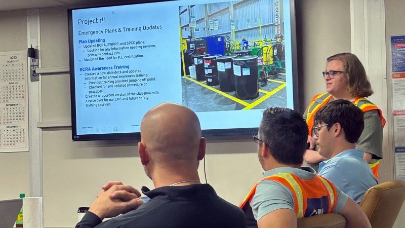
Protecting People and Planet: ESHS Student Drives Real-World Change at General Motors (GM) on Environmental Engineering Co-op
Matthew Huth Motivated by living through environmental tragedies like Hurricane Katrina, Matthew translated RIT's practical skills into a high-impact co-op, implementing a lasting recycling program at General...
Read More about Protecting People and Planet: ESHS Student Drives Real-World Change at General Motors (GM) on Environmental Engineering Co-op -
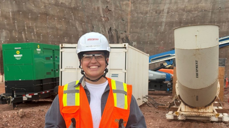
Full-Time Before Graduation: How RIT’s ESHS BS/MS Launched a Safety Specialist Career
Emersen Bartsch Learn how graduating student Emersen secured a full-time Safety Specialist role with a major electrical contractor in Colorado before completing their degree.
Read More about Full-Time Before Graduation: How RIT’s ESHS BS/MS Launched a Safety Specialist Career -

ESHS Student finds surprising fit with Electric Vehicle Team
Janet, a third-year environmental sustainability, health and safety and economics major from Rockville, MD., is the team manager of the RIT Electric Vehicle Team, a collegiate electric motorcycle...
Read More about ESHS Student finds surprising fit with Electric Vehicle Team -
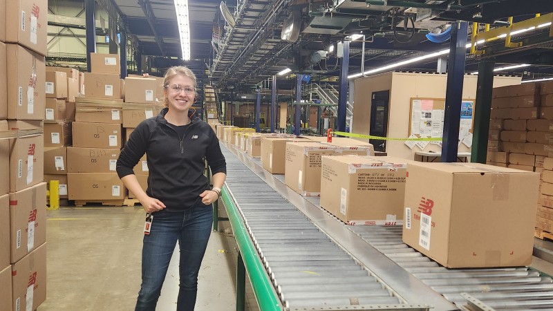
First-Gen to Fortune 100: Alum's Journey to Tesla and New Balance
Discover how first-gen student Leah's journey from a dairy farm to roles as Regional Safety Manager for Tesla’s Energy division and EHS Engineer for New Balance was made possible by her passion, RIT's...
Read More about First-Gen to Fortune 100: Alum's Journey to Tesla and New Balance -
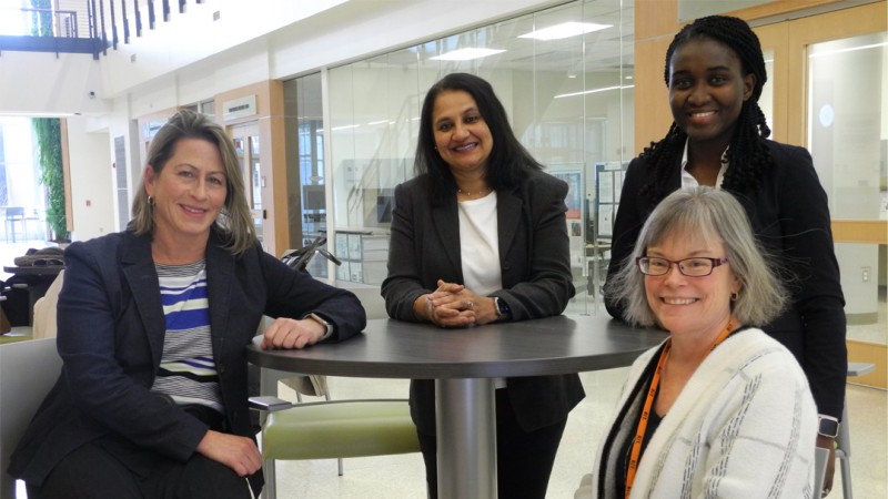
Research team awarded grant from NIST to develop new standards-based educational modules
Lisa Greenwood, Jennifer Schneider New work includes topics in smart energy grid security, sustainability and infrastructure resiliency to climate change.
Read More about Research team awarded grant from NIST to develop new standards-based educational modules -

From Engineering to EHS: One Alumna's Journey and Key Career Tips
Discover how an RIT alumna’s unexpected shift from engineering to Environmental Sustainability, Health, and Safety (EHS) led her to a fulfilling career, and learn her advice for high school students...
Read More about From Engineering to EHS: One Alumna's Journey and Key Career Tips


Related News
-
February 17, 2025

Engineering technology faculty addressing green skills shortage in engineering education through new grant
Integrating the development of eco-friendly practices with social and economic facets of sustainability, could further transform engineering education by equipping future engineers with the skill set required for the profession today.
-
December 2, 2024

RIT student finds surprising fit with Electric Vehicle Team
Janet Hackman, a third-year economics and environmental sustainability, health and safety major from Rockville, Md., is the team manager of the RIT Electric Vehicle Team, a collegiate electric motorcycle racing team founded in 2012.
-
February 13, 2024

RIT eco-friendly initiative reimplements packaged water policy starting April 1
RIT is reimplementing its policy against the use of packaged water, beginning April 1, when university funds may no longer be used to purchase still, unflavored, or packaged water. The policy applies to all single-serve water regardless of container material, size, event type, and method of purchase.