New book release shines light on the mid-century designer behind the ‘World Geo-Graphic Atlas’
RIT Press
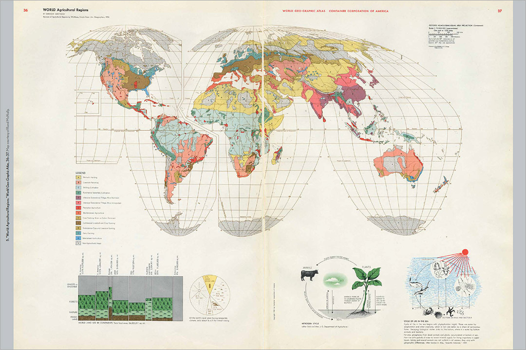
Herbert Bayer’s use of original graphic designs and topographical maps made scientific information accessible in this map of agricultural regions reprinted in Herbert Bayer's World Geo-Graphic Atlas and Information Design at Mid-Century.
The story behind an atlas and landmark work of graphic design is the focus of a new book about designer Herbert Bayer’s contributions to information design and visual education.
RIT Press
In Herbert Bayer's World Geo-Graphic Atlas and Information Design at Mid-Century, author Benjamin Benus explores the story behind the landmark work of graphic design.
Herbert Bayer's World Geo-Graphic Atlas and Information Design at Mid-Century, written by Benjamin Benus, and published by RIT Press, recounts the design and production of the atlas between 1947 and 1953. The study lends insight into the role 20th century artists and designers, such as Bayer and his collaborators, played in popularizing scientific knowledge and shaping audiences’ geographical worldviews.
Bayer was an Austrian-born artist who had trained at the Bauhaus, the German art school famous for its modern design principles. His artistic vision shaped the collaborative effort that produced the atlas commissioned by the Container Corporation to mark its 25th anniversary.
The designer’s graphic techniques and modernist vision throughout the World Geo-Graphic Atlas created a “visual dialogue” that Benus said “constitutes an important aspect of the Atlas’ achievement.”
Bayer’s map imagery, thematic diagrams, and geographic concepts have had a lasting impact within the fields of information design and visual education. The use of original graphics and full-page topographical maps provided by Rand McNally and the Italian cartographer Istituto Geografico De Agostini made the book engaging and easy to understand. This approach transformed the look and character of geographic atlases and popular scientific illustration.
More information about Herbert Bayer's World Geo-Graphic Atlas and Information Design at Mid-Century is available at the RIT Press website.