NASA awards RIT $2.2 million to extend Landsat satellite program collaboration
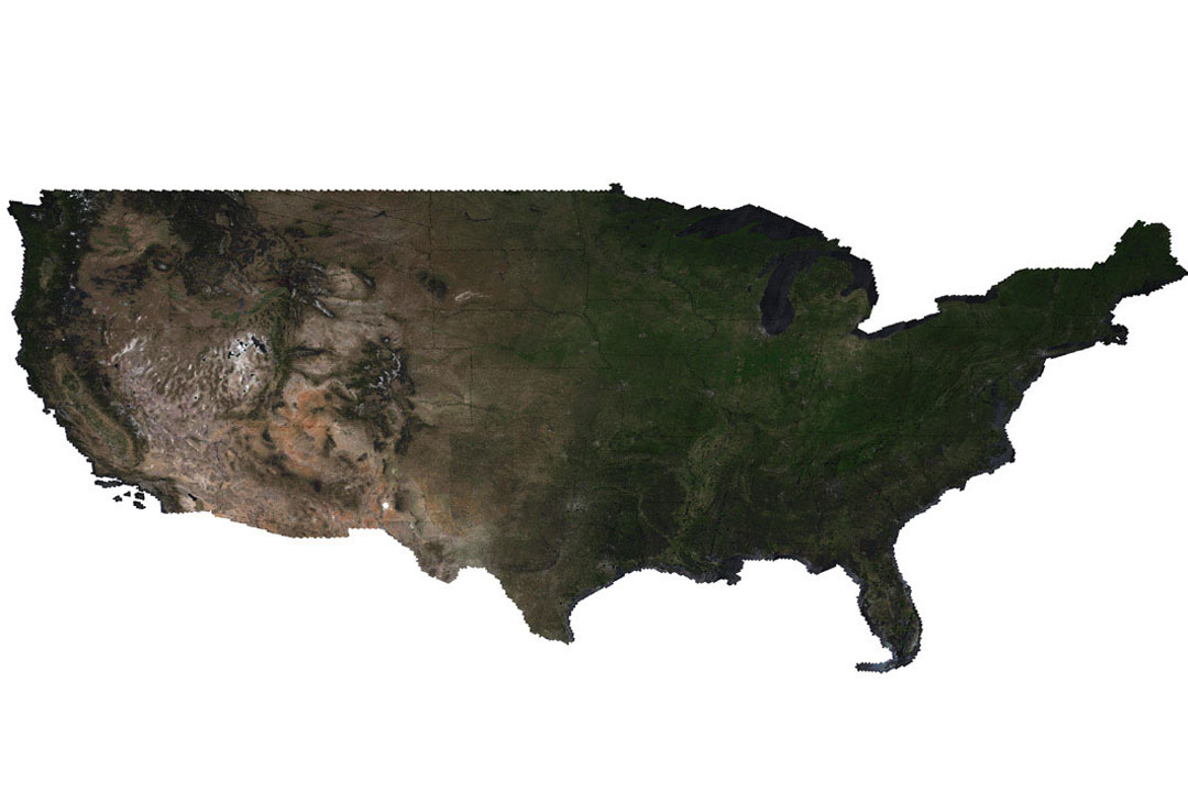
This simulation of the continental U.S. was created by an RIT researcher to help test image data development prior to launch.
Rochester Institute of Technology’s decades-long partnership with the federal Landsat program will continue with a $2.2 million grant from NASA.
Landsat is a NASA/USGS program that began in 1972 and provides the longest continuous space-based record of Earth’s land in existence. Data from Landsat gives information essential for making informed decisions about Earth’s resources and environment.
Rehman Eon and Aaron Gerace, research faculty members in the Chester F. Carlson Center for Imaging Science, are leading the project that will prepare Landsat 10, formerly known as Landsat Next, for a successful deployment in 2031.
“We’re excited to continue this work with NASA,” said Gerace. “We essentially conduct simulated sensor trade-studies for the imaging sensor to illustrate the impact of sensor design on image quality.”
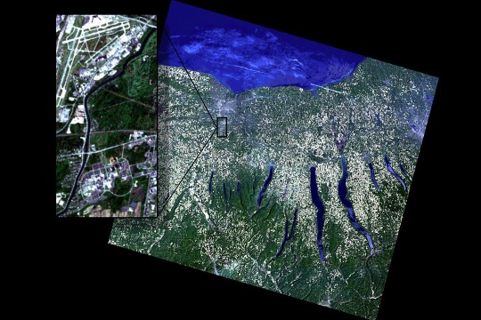
The Landsat Instrument Suite (LandIS) sensors differ significantly from previous sensors used for Landsat missions as it will acquire image data across 26 spectral bands at a higher spatial resolution. To ensure that LandIS has ultimate image quality to achieve its science objectives, the RIT team will provide critical analyses through targeted simulation and modeling studies to help the Landsat program make informed decisions regarding the LandIS sensor.
Landsat 10 will continue the program’s legacy of observing, managing, and adapting to Earth’s changing surface. The mission helps scientists study water quality and aquatic health assessments; crop productions and soil conservation; forest management and monitoring; climate and snow dynamics research; and mineral mapping based on thermal emissivity.
“The design of this new instrument is important,” said Eon. “Not only will it provide continuity with previous Landsat sensors, but it will enable emerging science applications due to its improved spectral and spatial resolutions.”
Eon and Gerace use the DIRSIG (Digital Imaging and Remote Sensing Image Generation) model as part of the Landsat Science Team. They will be using a large-scale synthetic scene that they developed during the former contract to simulate proxy data that the various science users can apply their algorithms to.
DIRSIG was developed at RIT in the late 1980s. RIT researchers have a working history with Landsat dating back to 1981 when NASA funded RIT’s first major research grant that helped establish the imaging science program. Imaging science is an interdisciplinary field combining computer science, engineering, and physics to explore image creation, perception, and analysis.
The Chester F. Carlson Center for Imaging Science offered the first imaging science program in the U.S. and is currently the only formal imaging science program in the nation. Eon and Gerace are both graduates of the imaging science Ph.D. program, where they worked on Landsat research as students.
“This new grant from NASA shows the value of our imaging science background,” added Gerace. “All five researchers that support this project graduated from the program and we are able to use techniques that we learned to build large synthetic landscapes, for example, to conduct studies that are impactful for NASA and USGS.”